
Hide
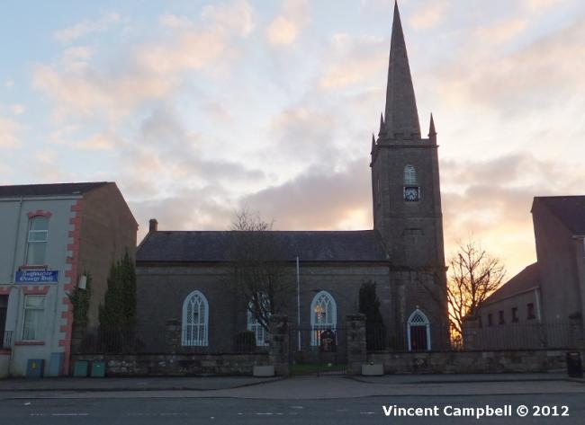
St James, Aughnacloy, Church of Ireland
hide
Hide
Hide
St James,
Moore Street,
Aughnacloy
Moore Street,
Aughnacloy
Hide
It was founded in 1736.
A booklet entitled "History of Carnteel Parish" was published in 1986.
It is located at NV7723713550 (Lat/Lon 54.414643, -6.976889). You can see this on maps provided by:
- OpenStreetMap
- Google Maps
- Bing (was Multimap)
- Vision of Britain (Click "Historical units & statistics" for administrative areas.)
- Copy
St James, Aughnacloy, Church of Irelandand paste it along with the county name into the search box at Ordnance Survey Ireland. - GeoHack (Links to on-line maps and location specific services.)