
Hide
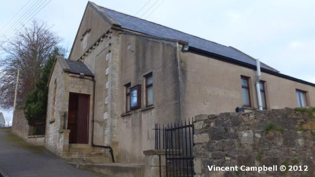
Church Hill Road, Caledon, Methodist (Wesleyan)
hide
Hide
Hide
Methodist (Wesleyan) church,
Church Hill Road,
Caledon
Church Hill Road,
Caledon
Hide
It is now closed, but we do not know the date of closure. The building subsequently put to use as the Elim Penticostal Church.
It was located at NV8580506009 (Lat/Lon 54.352479, -6.837378). You can see this on maps provided by:
- OpenStreetMap
- Google Maps
- Bing (was Multimap)
- Vision of Britain (Click "Historical units & statistics" for administrative areas.)
- Copy
Church Hill Road, Caledon, Methodist (Wesleyan)and paste it along with the county name into the search box at Ordnance Survey Ireland. - GeoHack (Links to on-line maps and location specific services.)