Hide
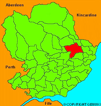
Brechin
hide
Hide
"A royal burgh in the county of Angus, which was in former times an episcopal see, and the county town. It is situated on the side of a hill, the foot of which is washed by the river Southesk. The royalty extends half a mile every way from the cross, but the suburbs extend a considerable way further: towards the east and south are the tenements, as they are called; they are independant of the burgh, and held in feu from Sir David Carnegie of Southesk. Brechin was a rich bishopric, founded in the year 1150 by David I and very richly endowed. Near the church is one of those round towers, of which there is only another in Scotland, at Abernethy. The soil of the country round Brechin is in general very good, and fertile; and its vicinity to Montrose, from whcih it is distant 8 miles, gives the former a near port for the shipping of his superabundant grain. The tide comes within two miles of the town and at a very trifling expense, vessels of 50 tons might be brought within a mile or half of it. The osnaburgh and brown linen manufactory has been carried on to considerable extent, and of late a good deal has been done in the sail cloth trade."
The Gazetteer of Scotland, W Chalmers, Dundee 1803
Hide
| St Andrew, Brechin, Scottish Episcopal |
| Brechin Cathedral, Brechin, Church of Scotland |
| St Ninian, Brechin, Roman Catholic |
- The transcription of the section for Brechin from the National Gazetteer (1868) provided by Colin Hinson.
- Ask for a calculation of the distance from Brechin to another place.
You can see maps centred on OS grid reference NO594592 (Lat/Lon: 56.722957, -2.665576), Brechin which are provided by:
- OpenStreetMap
- Google Maps
- StreetMap (Current Ordnance Survey maps)
- Bing (was Multimap)
- Old Maps Online
- National Library of Scotland (Old Ordnance Survey maps)
- Vision of Britain (Click "Historical units & statistics" for administrative areas.)
- Magic (Geographic information) (Click + on map if it doesn't show)
- GeoHack (Links to on-line maps and location specific services.)
- All places within the same township/parish shown on an Openstreetmap map.
- Nearby townships/parishes shown on an Openstreetmap map.
- Nearby places shown on an Openstreetmap map.

