
Hide
Fearn
hide
Hide
"The parish of Fearn lies 8 miles from Forfar, Brechin and Kirriemuir. It measures 7 miles by 3 miles. It is bounded on the south-west by Tannadice, on the north by Lethnot & Navar and on the east by Menmuir and Careston. The habits of the population are completely rural. The only places of common resort are the parish church and school. We have no tavern, no newsroom, no lodge, no clubs and no special association which we can call our own. A farm labourer earns 1/8d. per day; a horseman £10 or £12 per annum plus house, garden, oatmeal and milk. In the winter female industry is almost unavailable. There are 16 farms, of from 50 to 300 acres each, plus 170 acres of woodland and plantations. Wheat, barley and rye are the only kinds of grain ever sown. Potatoes are scarcely cultivated for the market because of the heavy carriage. No turnpike passes through the parish and no stage coach either."
Edited from The New Statistical Account of Scotland, Angus, 1836.
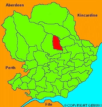
Click on the map to access more maps of Fearn.
Hide
| Fern Parish Church, Fearn, Church of Scotland |
| Fern Parish Church, Fearn, Church of Scotland |
- The transcription of the section for Fearn from the National Gazetteer (1868) provided by Colin Hinson.
- Ask for a calculation of the distance from Fearn to another place.
You can see maps centred on OS grid reference NO492636 (Lat/Lon: 56.761135, -2.832775), Fearn which are provided by:
- OpenStreetMap
- Google Maps
- StreetMap (Current Ordnance Survey maps)
- Bing (was Multimap)
- Old Maps Online
- National Library of Scotland (Old Ordnance Survey maps)
- Vision of Britain (Click "Historical units & statistics" for administrative areas.)
- Magic (Geographic information) (Click + on map if it doesn't show)
- GeoHack (Links to on-line maps and location specific services.)
- All places within the same township/parish shown on an Openstreetmap map.
- Nearby townships/parishes shown on an Openstreetmap map.
- Nearby places shown on an Openstreetmap map.