
Hide
Guthrie
hide
Hide
"The parish of Guthrie consists of 2 portions, one of which (Kirkbuddo) is separated from the other, where the church is, by an interval of seven miles. The northern portion, in which the church stands, is bounded on the south by Kirkden and Rescobie, on the west by Rescobie and Aberlemno, on the north by Aberlemno and on the east by Kinnell. The south (Kirkbuddo) portion is bounded on the north by Dunnichen, on the west by Inverarity, on the south by Inverarity and Monikie, and on the east by Carmylie. There are about 3200 acres of cultivated land in the parish, plus about 660 acres under wood and moor. The parish contains neither town nor village. The nearest post town is Forfar, but the chief communication takes place with Arbroath. There is an alehouse in the Kirktown and another on the east boundary of the parish. Coals are the chief fuel used, brought from Arbroath."
Edited from The New Statistical Account of Scotland, Angus, 1842.
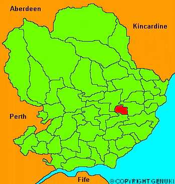
Click on the map to access more maps of Guthrie.
Hide
| Guthrie Parish Church, Guthrie, Church of Scotland |
| Guthrie Parish Church, Guthrie, Church of Scotland |
| St Lawrence or Boath Chapel, Boath, Church of Scotland |
- The transcription of the section for Guthrie from the National Gazetteer (1868) provided by Colin Hinson.
- Ask for a calculation of the distance from Guthrie to another place.
You can see maps centred on OS grid reference NO574513 (Lat/Lon: 56.651837, -2.696815), Guthrie which are provided by:
- OpenStreetMap
- Google Maps
- StreetMap (Current Ordnance Survey maps)
- Bing (was Multimap)
- Old Maps Online
- National Library of Scotland (Old Ordnance Survey maps)
- Vision of Britain (Click "Historical units & statistics" for administrative areas.)
- Magic (Geographic information) (Click + on map if it doesn't show)
- GeoHack (Links to on-line maps and location specific services.)
- All places within the same township/parish shown on an Openstreetmap map.
- Nearby townships/parishes shown on an Openstreetmap map.
- Nearby places shown on an Openstreetmap map.