
Hide
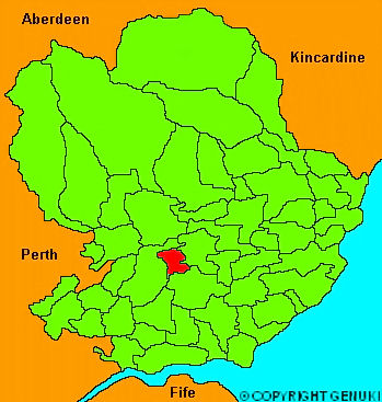
Kinnettles
hide
Hide
"A parish in the county of Forfar, nearly a square of four miles. The soil is clay, variously mixed with loam and sand: the greater part is enclosed and well cultivated, yielding good crops of oats, barley and some wheat and flax. The mansion houses of Major Douglas of Brigton, of Mr Bower of Kincaldrum and Mr Simpson of Invereighty, and the pleasure grounds, give the whole parish a delightful appearance."
The Gazetteer of Scotland, W Chalmers, Dundee 1803.
Hide
| Kinnettles Kirk, Kinnettles, Church of Scotland |
- The transcription of the section for Kinnettles from the National Gazetteer (1868) provided by Colin Hinson.
- Ask for a calculation of the distance from Kinnettles to another place.
You can see maps centred on OS grid reference NO426470 (Lat/Lon: 56.611345, -2.936749), Kinnettles which are provided by:
- OpenStreetMap
- Google Maps
- StreetMap (Current Ordnance Survey maps)
- Bing (was Multimap)
- Old Maps Online
- National Library of Scotland (Old Ordnance Survey maps)
- Vision of Britain (Click "Historical units & statistics" for administrative areas.)
- Magic (Geographic information) (Click + on map if it doesn't show)
- GeoHack (Links to on-line maps and location specific services.)
- All places within the same township/parish shown on an Openstreetmap map.
- Nearby townships/parishes shown on an Openstreetmap map.
- Nearby places shown on an Openstreetmap map.