
Hide
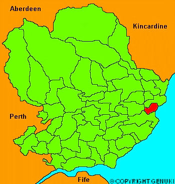
Lunan
hide
Hide
"Lying on the bay of Lunan, where the river of that names discharges itself into the German Ocean. It is of rectangular figure, 2 miles long, and 1 broad; containing 1411 acres, of which 973 are arable. The surface towards the bay is flat, rising rapidly from the plain and river towards the North; the soil in the higher parts is shallow and wet, from lying upon a bed of muirstone rock; the lower grounds are deep and fertile, except close to the sea, where it is sandy. It is distant seven miles from Arbroath, and five and a half from Montrose."
The Gazetteer of Scotland, W Chalmers, Dundee 1803.
Hide
| St Margaret, Lunanhead, Scottish Episcopal |
| Lunan Church, Lunan, Church of Scotland |
- The transcription of the section for Lunan from the National Gazetteer (1868) provided by Colin Hinson.
- Ask for a calculation of the distance from Lunan to another place.
You can see maps centred on OS grid reference NO679521 (Lat/Lon: 56.659335, -2.525429), Lunan which are provided by:
- OpenStreetMap
- Google Maps
- StreetMap (Current Ordnance Survey maps)
- Bing (was Multimap)
- Old Maps Online
- National Library of Scotland (Old Ordnance Survey maps)
- Vision of Britain (Click "Historical units & statistics" for administrative areas.)
- Magic (Geographic information) (Click + on map if it doesn't show)
- GeoHack (Links to on-line maps and location specific services.)
- All places within the same township/parish shown on an Openstreetmap map.
- Nearby townships/parishes shown on an Openstreetmap map.
- Nearby places shown on an Openstreetmap map.