
Hide
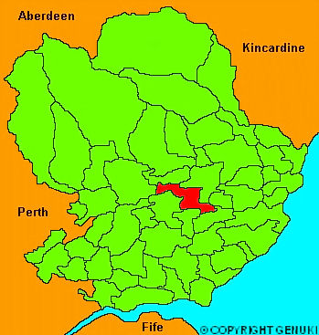
Rescobie
hide
Hide
" .... of an irregular figure, comprehending about 16 or 18 miles, mostly in cultivation, with some thriving fir plantations, and very little waste ground. The soil is various, being partly rich and fertile, and partly poor and unproductive; but of late, has been greatly improved by the use of marl, which is found not only in the loch of Rescobie, which occupies the middle part of the parish, but also in the lochs of Balgavies and Restenet, one of which bounds it on the North East, the other on the South West. The loch of Rescobie is about a mile long, and half a mile broad, and is one of the lakes formed by the river Lunan, in its course towards the bay of Lunan, where it discharges itself into the ocean."
The Gazetteer of Scotland, W Chalmers, Dundee 1803.
Hide
| Rescobie Parish Church, Rescobie, Church of Scotland |
| Rescobie Parish Church, Rescobie, Church of Scotland |
- The transcription of the section for Rescobie from the National Gazetteer (1868) provided by Colin Hinson.
- Ask for a calculation of the distance from Rescobie to another place.
You can see maps centred on OS grid reference NO505515 (Lat/Lon: 56.652783, -2.80925), Rescobie which are provided by:
- OpenStreetMap
- Google Maps
- StreetMap (Current Ordnance Survey maps)
- Bing (was Multimap)
- Old Maps Online
- National Library of Scotland (Old Ordnance Survey maps)
- Vision of Britain (Click "Historical units & statistics" for administrative areas.)
- Magic (Geographic information) (Click + on map if it doesn't show)
- GeoHack (Links to on-line maps and location specific services.)
- All places within the same township/parish shown on an Openstreetmap map.
- Nearby townships/parishes shown on an Openstreetmap map.
- Nearby places shown on an Openstreetmap map.