
Hide
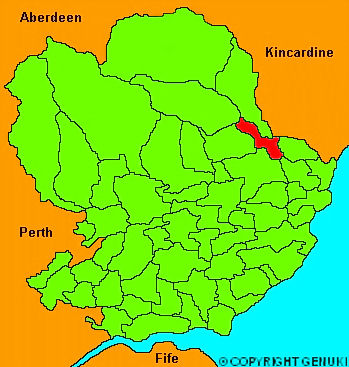
Stracathro
hide
Hide
" .... about 7 miles long and 2 broad, stretching across the valley of Strathmore. The surface, which rises at each extremity, is uncommonly pleasant; and the soil varies from a rich clay to a black gravel, though the former is the most prevalent. Very little of the parish is enclosed; but, upon the whole, considerable attention is payed to the agriculture. Freestone and limestone are abundant; but, thoguh the latter is wrought, the great distance and expense of fuel render the advantage which might accrue from it less general. The churchyard of Stracathro is noted as having been the scene of the abject surrender of the crown of Scotland by John Balliol to King Edward I in 1296."
The Gazetteer of Scotland, W Chalmers, Dundee 1803.
Hide
| Stracathro Church, Stracathro, Church of Scotland |
| Stracathro Church, Stracathro, Church of Scotland |
- The transcription of the section for Stracathro from the National Gazetteer (1868) provided by Colin Hinson.
- Ask for a calculation of the distance from Stracathro to another place.
You can see maps centred on OS grid reference NO601657 (Lat/Lon: 56.781393, -2.654131), Stracathro which are provided by:
- OpenStreetMap
- Google Maps
- StreetMap (Current Ordnance Survey maps)
- Bing (was Multimap)
- Old Maps Online
- National Library of Scotland (Old Ordnance Survey maps)
- Vision of Britain (Click "Historical units & statistics" for administrative areas.)
- Magic (Geographic information) (Click + on map if it doesn't show)
- GeoHack (Links to on-line maps and location specific services.)
- All places within the same township/parish shown on an Openstreetmap map.
- Nearby townships/parishes shown on an Openstreetmap map.
- Nearby places shown on an Openstreetmap map.