Hide
Cadder, Church of Scotland
hide
Hide
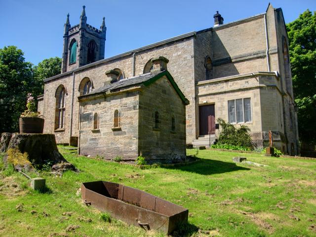
Cadder: Parish Church, watchhouse and iron mortsafe
Cadder Parish Church lies close to the Forth and Clyde canal. This was to the advantage of 19th century grave-robbers in that it provided rapid transport to the anatomy schools in Glasgow and Edinburgh. It is perhaps not surprising, therefore that the graveyard contains not only an iron mortsafe to protect the newly dead but also a watchhouse to provide shelter to the watchers guarding the graves.
Hide
Cadder, Lanarkshire
© Copyright Martyn Gorman and licensed for reuse under this Creative Commons Licence.
Hide
Church of Scotland,
Cadder
Hide
^Click the arrow on the line above to find links to search for web sites of current churches when one is not listed here, or within the address.
It is located at NS6157272332 (Lat/Lon 55.924079, -4.216919). You can see this on maps provided by:
- OpenStreetMap
- Google Maps
- StreetMap (Current Ordnance Survey maps)
- Bing (was Multimap)
- Old Maps Online
- National Library of Scotland (Old Ordnance Survey maps)
- Vision of Britain (Click "Historical units & statistics" for administrative areas.)
- Magic (Geographic information) (Click + on map if it doesn't show)
- GeoHack (Links to on-line maps and location specific services.)

