
Hide
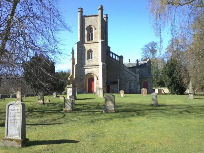
Cranston Parish Church, Cranston, Church of Scotland
hide
Hide
Hide
Cranston Parish Church,
Cranston
Hide
It was founded in 1824.
Built in 1824, and rebuilt following a fire in 1861. The war memorial indicates that this was a United Free church in 1914-1919.
Old Parish Registers (OPRs) are available from 1682 (Births), 1784 (Marriages), and 1738 (deaths).
The Deaths are record for a short period around the 1740's, restarting in 1833.
Full details of the available records, gaps, etc can be found from the NRS.
It is located at NT3843065571 (Lat/Lon 55.879339, -2.985701). You can see this on maps provided by:
- OpenStreetMap
- Google Maps
- StreetMap (Current Ordnance Survey maps)
- Bing (was Multimap)
- Old Maps Online
- National Library of Scotland (Old Ordnance Survey maps)
- Vision of Britain (Click "Historical units & statistics" for administrative areas.)
- Magic (Geographic information) (Click + on map if it doesn't show)
- GeoHack (Links to on-line maps and location specific services.)
Details of the War Memorial at the parish church can be found on the IWM.