
Hide
Parish Maps from 'Historic Parishes of England and Wales - Boundaries before 1850'
hide
Hide
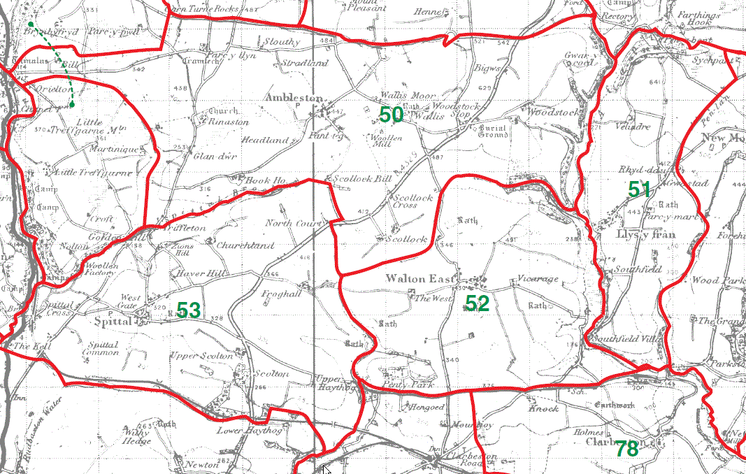
Ambleston Parish Map 50
Llys-y-fran Parish Map 51
Walton East Parish Map 52
Spittal Parish Map 53
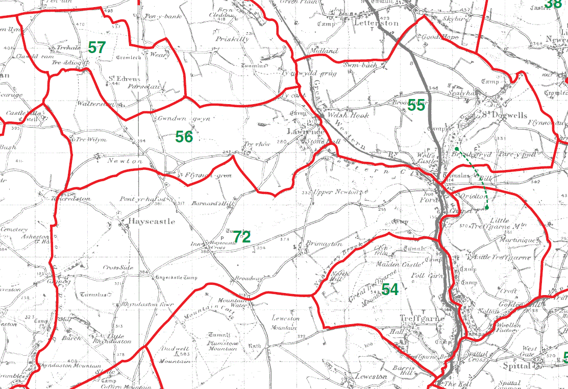
Treffgarne Parish Map 54
St Dogwells Parish Map 55
St Lawrence Parish Map 56
St Edrins Parish Map 57
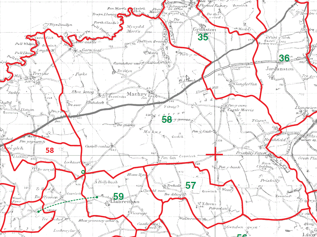
Mathry Parish Map 58 & 58
[Number 58 added to unnumbered detached part of Mathry parish map]
Llanreithan Parish Map 59
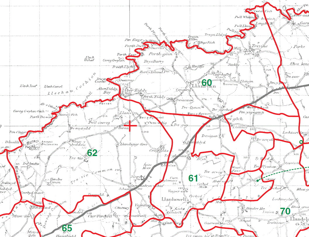
Llanrhian Parish Map 60
Llanhowell Parish Map 61
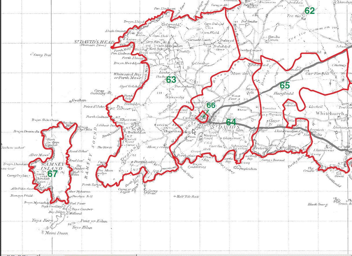
St David's Parish Map
Cylch mawr 62
St David's Parish Map
Cylch gwaelod 63
Cylch y dre 64
Cylch bychan 65
Cathedral Close 66
Ramsey Island 67
This map is extracted from:
Kain, R.J.P., Oliver, R.R., Historic Parishes of England and Wales: an Electronic Map of Boundaries before 1850 with a Gazetteer and Metadata [computer file]. Colchester, Essex: History Data Service, UK Data Archive [distributor], 17 May 2001. SN: 4348.
Acknowledgement is made to R.J.P. Kain, R.R Oliver, the Economic and Social Research Council, the History Data Service and the UK Data Archive.
(Gareth Hicks, 27 Dec 2012)