
Hide
Parish Maps from 'Historic Parishes of England and Wales - Boundaries before 1850'
hide
Hide
Clydey Parish Map 11
Cilrhedyn Parish Map 12
Penrith Parish Map 13A & (Chapelry of Castellan) 13B
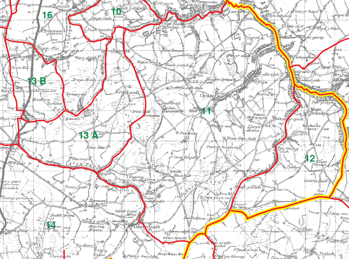
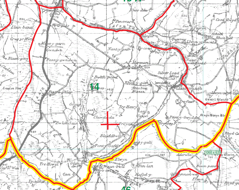
Llanfyrnach Parish Map 14
Llanfair-nant-gwyn Parish Map 15
Llanfihangel Penbedw Parish Map 16
Whitechurch Parish Map 17
Meline Parish Map 18
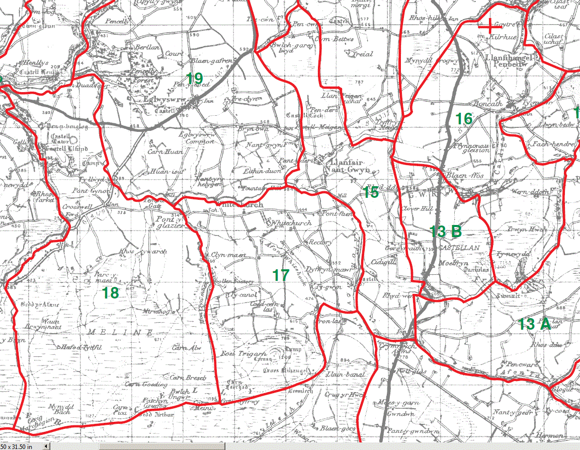
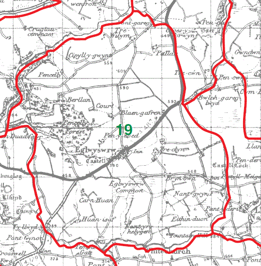
Eglwyswrw Parish Map 19
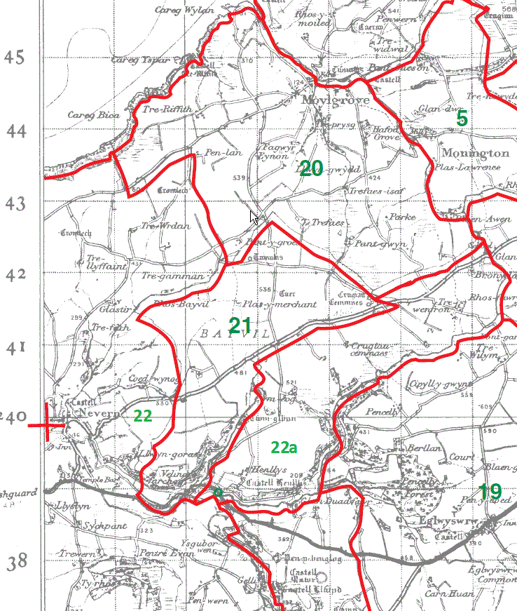
Moylgrove Parish Map 20
Bayvil Parish Map 21
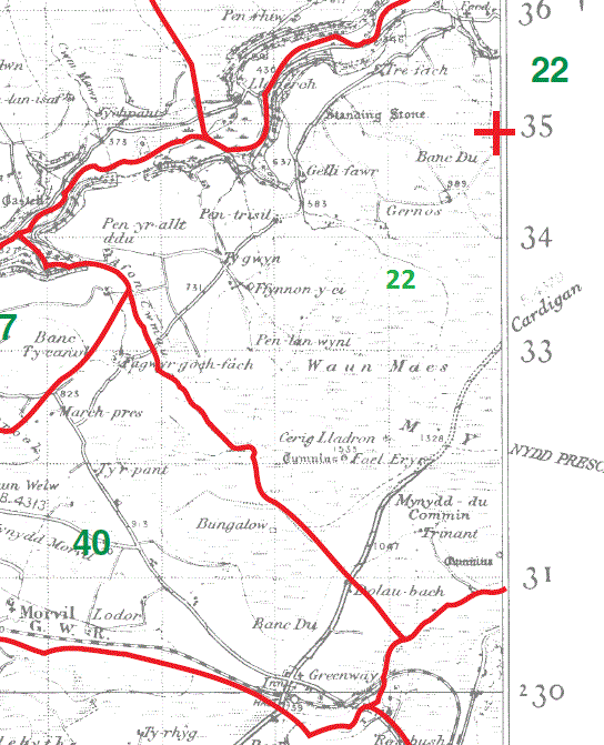
Nevern Parish Map part 22
Nevern Parish Map part 22a (unmarked on Kain/Oliver map)
Nevern Parish Map part 22
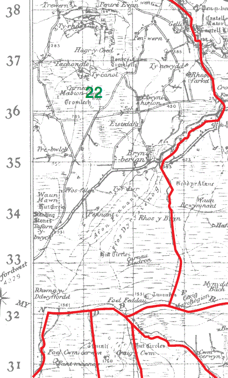
Nevern Parish Map part 22
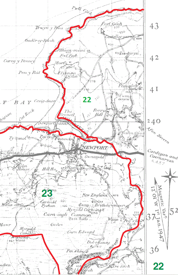
Nevern Parish Map part 22
This map is extracted from:
Kain, R.J.P., Oliver, R.R., Historic Parishes of England and Wales: an Electronic Map of Boundaries before 1850 with a Gazetteer and Metadata [computer file]. Colchester, Essex: History Data Service, UK Data Archive [distributor], 17 May 2001. SN: 4348.
Acknowledgement is made to R.J.P. Kain, R.R Oliver, the Economic and Social Research Council, the History Data Service and the UK Data Archive.
[Gareth Hicks: 27 Dec 2012]