
Hide
Parish Maps from 'Historic Parishes of England and Wales - Boundaries before 1850'
hide
Hide
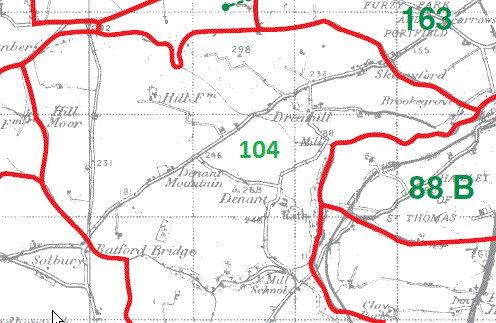
Steynton Parish Map part 104
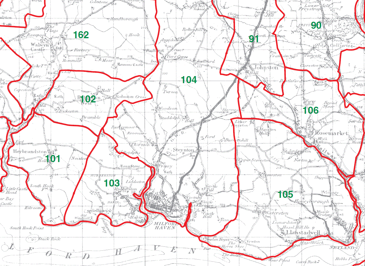
Herbrandston Parish Map 101
Robeston West Parish Map 102
Hubberston Parish Map 103
Steynton Parish Map part 104
Llanstadwell Parish Map 105
Rosemarket Parish Map 106
Burton Parish Map 107
Llangwm Parish Map 108
Coedcanlas Parish Map 109
Martletwy Parish Map 110
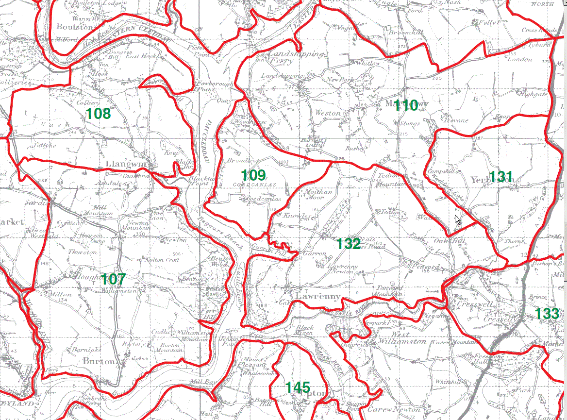
Minwear Parish Map 111
Newton North Parish Map 112
Mounton Parish Map part 113
Robeston Wathen Parish Map part 114
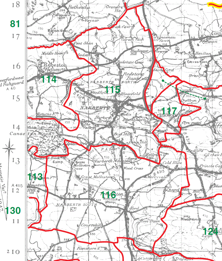
Narberth Parish Map (North) part 115
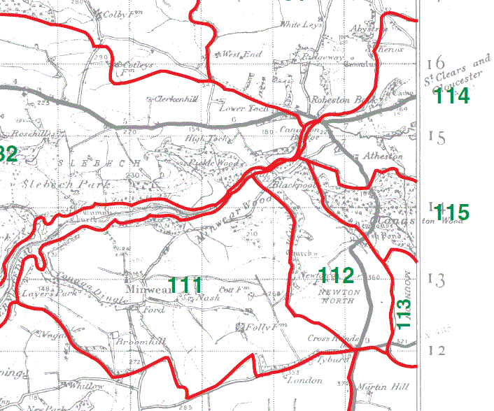
Mounton Parish Map part 113
Robeston Wathen Parish Map part 114
Narberth Parish Map (North) part 115
Narberth Parish Map (South) 116
Crinow Parish Map 117
This map is extracted from:
Kain, R.J.P., Oliver, R.R., Historic Parishes of England and Wales: an Electronic Map of Boundaries before 1850 with a Gazetteer and Metadata [computer file]. Colchester, Essex: History Data Service, UK Data Archive [distributor], 17 May 2001. SN: 4348.
Acknowledgement is made to R.J.P. Kain, R.R Oliver, the Economic and Social Research Council, the History Data Service and the UK Data Archive.
(Gareth Hicks 30 Dec 2012)
Copyright © GENUKI and Contributors 1996 to date |