
Hide
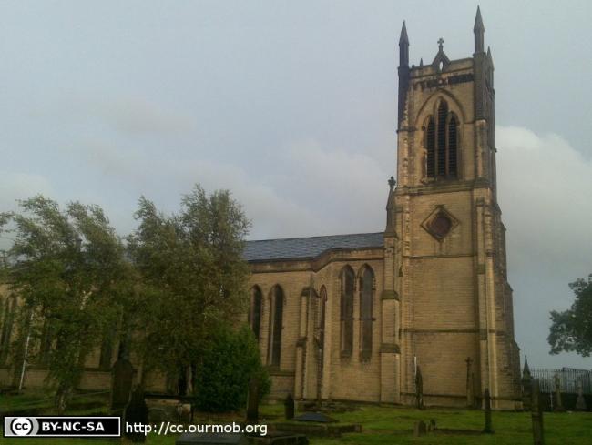
St John the Evangelist, Dukinfield, Church of England
hide
Hide
Hide
St John the Evangelist,
Oxford Rd,
Dukinfield
Hide
It was founded in 1841.
Vicarage Drive/Oxford Road.
Church History
Built in 1841 as a chapel to Stockport: St. Mary the Virgin, becoming the district church for the township of Dukinfield in 1843. The boundaries of "The Chapelry District of Saint John the Evangelist, Dukenfield" [sic] were described in the London Gazette on 10 January 1843:
"The chapelry district of Saint John the Evangelist, Dukenfield, is to consist of the township of Dukenfield,. the same being bounded on the north by the parish of Ashton-under-Lyne; on the west by the river Mersey, which divides it from the parish of Manchester; and on the south and cast by the parish, of Mottram in Longdendale"
The district was affected by the following boundary changes:
- 1846 February 13 — reduced when part of the township of Dukinfield was transferred to Dukinfield: St. Mark.
- 1846 March 24 — reduced when part of the township of Dukinfield was transferred to Stalybridge: Holy Trinity.
- 1880 February 27 — reduced when part of the township of Dukinfield was transferred to Stalybridge: Christ Church.
- 1906 May 18 — reduced when part of the township of Dukinfield was transferred to Dukinfield: St. Luke.
- 1906 December 11 — reduced when the following area was transferred to Dukinfield: St. Mark: "All that portion of the said new parish of Saint John the Evangelist, Dukinfield, which is bounded upon the north-east by the parish of Ashton-under-Lyne, in the county of Lancaster and in the diocese of Manchester, upon the west by the said new parish of Saint Mark, Dukinfield, upon the south by the consolidated chapelry of Saint Luke, Dukinfield, in the said county of Chester and in the said diocese of Chester, and upon the remaining side, that is to say upon the east, by an imaginary line commencing upon the boundary which divides the said consolidated chapelry of Saint Luke, Dukinfield, from the said new parish of Saint John the Evangelist, Dukinfield, at a point in the middle of the eastern end of Cemetery Troad at the entrance to the Dukinfield cemetery, and extending thence north-westward to and along the wall forming the western boundary of the Dukinfield cemetery for a distance of ten chains or thereabouts to its northern end on the southern side of Park-road, and continuing thence north-westward in precisely the same direction and in a straight line (thereby crossing Park-road and the Eiver Tame) for a distance of two chains or thereabouts to a point on the northern bank of the said river upon the boundary which divides the said new parish of Saint John the Evangelist, Dukinfield, from the said parish of Ashton-under-Lyne."
Church Records
C = Christenings (Baptisms) ; M = Marriages ; B = Burials ; BTs = Bishop's Transcripts
| Original Registers | C 1841-1946 ; M 1842-1940 ; B 1841-1955 — Cheshire Archives (P 167) C from 1946 ; M from 1940 — Church |
| Microfilm Copies | C 1841-1946 ; M 1842-1940 ; B 1841-1955 — Cheshire Archives C 1841-1861 — Family History Society of Cheshire |
| Bishop's Transcripts | 1844-1854 (microfilmed) — Cheshire Archives |
| Copies and Indexes | M 1842-1987 — Cheshire BMD (TA:CE21) |
- OpenStreetMap
- Google Maps
- StreetMap (Current Ordnance Survey maps)
- Bing (was Multimap)
- Old Maps Online
- National Library of Scotland (Old Ordnance Survey maps)
- Vision of Britain (Click "Historical units & statistics" for administrative areas.)
- English Jurisdictions in 1851 (Unfortunately the LDS have removed the facility to enable us to specify a starting location, you will need to search yourself on their map.)
- Magic (Geographic information) (Click + on map if it doesn't show)
- GeoHack (Links to on-line maps and location specific services.)