
Hide
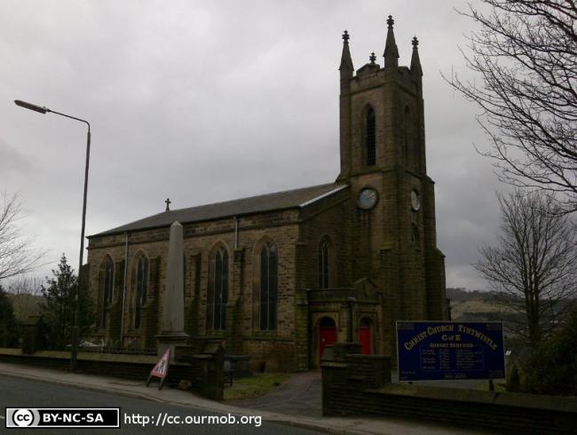
Christ Church, Tintwistle, Church of England
hide
Hide
Hide
Christ Church,
Church Street,
Tintwistle
Hide
It was founded in 1836.
Church History
In 1838 it became the district church for parts of the townships of Hollingworth and Tintwistle (previously served by Mottram In Longdendale: St. Michael).
The district was affected by the following boundary change:
- 1922 March 3 — reduced when the part of the township of Hollingworth was transferred to Hollingworth: St. Mary.
Church Records
C = Christenings (Baptisms) ; M = Marriages ; B = Burials ; BTs = Bishop's Transcripts
| Original Registers | C 1837-2013 ; M 1837-2002 ; B 1837-2012 — Cheshire Archives (P 205) C from 2013 ; M from 2002 ; B from 2012 — Church |
| Microfilm Copies | C 1837-1882 ; M 1837-1949 ; B 1837-1893 — Cheshire Archives M 1884-1920 — Family History Society of Cheshire |
| Bishop's Transcripts | 1837-1841, 1855 (microfilmed) — Cheshire Archives |
| Copies and Indexes | M 1839-1949 — Cheshire BMD (HP:C27) B 1841-1875 (transcript, 2 vols.) — Cheshire Archives |
| Monumental Inscriptions | Transcrip by C. D. Rogers — Cheshire Archives |
It is located at SK0217597226 (Lat/Lon 53.471764, -1.968706). You can see this on maps provided by:
- OpenStreetMap
- Google Maps
- StreetMap (Current Ordnance Survey maps)
- Bing (was Multimap)
- Old Maps Online
- National Library of Scotland (Old Ordnance Survey maps)
- Vision of Britain (Click "Historical units & statistics" for administrative areas.)
- English Jurisdictions in 1851 (Unfortunately the LDS have removed the facility to enable us to specify a starting location, you will need to search yourself on their map.)
- Magic (Geographic information) (Click + on map if it doesn't show)
- GeoHack (Links to on-line maps and location specific services.)