
Hide
St Catherine, Edge Hill, Church of England
hide
Hide
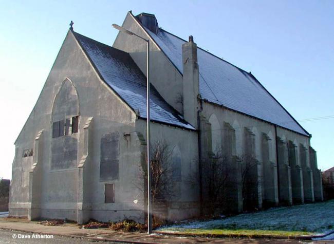
Photograph supplied by & Copyright of Dave Atherton.
Hide
St Catherine,
Harke St,
Edge Hill
Lancashire
Harke St,
Edge Hill
Lancashire
Hide
1813-1882
Transcript of monumental inscriptions 1813-1882 held by Lancashire Archives - MF 1/331
Baptisms
1832-1873
Copy of Bishop's Transcript of baptisms 1832-1873 held by Lancashire Archives - DRL 2/451-452
1863-1864
Copy of Bishop's Transcript of baptisms 1863-1864 held by Lancashire Archives - DRL 2/451
Marriages
1832-1842
Copy of Bishop's Transcript of marriages 1832-1842 held by Lancashire Archives - DRL 2/451-452
Burials
1832-1873
Copy of Bishop's Transcript of burials 1832-1873 held by Lancashire Archives - DRL 2/451-452
It was located at SJ3699789886 (Lat/Lon 53.402017, -2.949073). You can see this on maps provided by:
- OpenStreetMap
- Google Maps
- StreetMap (Current Ordnance Survey maps)
- Bing (was Multimap)
- Old Maps Online
- National Library of Scotland (Old Ordnance Survey maps)
- Vision of Britain (Click "Historical units & statistics" for administrative areas.)
- English Jurisdictions in 1851 (Unfortunately the LDS have removed the facility to enable us to specify a starting location, you will need to search yourself on their map.)
- Magic (Geographic information) (Click + on map if it doesn't show)
- GeoHack (Links to on-line maps and location specific services.)