Hide
Middleton
hide
Hide
This is the Middleton near Manchester. There is also a Middleton township near Lancaster.
Hide
hide
Hide
hide
Hide
Hide
"MIDDLETON, a town, a township, a sub-district, and a parish, in Lancashire. The town stands in a fertile vale, on the river Irk, at the terminus of a short branch of the Lancashire and Yorkshire railway, near the Rochdale canal, 6 miles N by E of Manchester; took its name from being situated in the centre of several circumjacent towns; was only a village of 20 houses in 1770; has risen, since 1780, into a populous seat of manufacture; is now an important place, nearly a mile in length, well supplied with water, thoroughly drained, and under the management of a local improvement board by act of 1861; is so conjoined with Tonge in both proximity and trade as practically to include or absorb that town; carries on industry in extensive silk factories, in numerous large cotton factories, in calico-printing, bleaching, and dyeing establishments, in iron foundries, and in machinemaking establishments; publishes a weekly newspaper; is a seat of petty sessions; and has a post office under Manchester, a railway station with telegraph, several good inns, a police station, a market-house, public baths, two churches, five dissenting chapels, a Roman Catholic chape1, a grammar school, two national and infant schools, a free library, a church reading-room and library, an agricultural society, and a floral and horticultural society."
More ...
John Marius Wilson, Imperial Gazetteer of England and Wales (1870-72)
Hide
Local studies information is held at Middleton library.
Details about the census records, and indexes for Middleton.
- Ask for a calculation of the distance from Middleton to another place.
In 1835 the parish of Middleton contained the townships of Middleton, Ashworth, Birtle cum Bamford, Great Lever, Ainsworth, Hopwood, Pilsworth and Thornham,
Information about boundaries and administrative areas is available from A Vision of Britain through time.

View maps of Middleton and places within its boundaries.
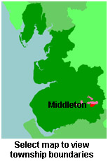
View a map of the boundaries of this town/parish.
You can see maps centred on OS grid reference SD869065 (Lat/Lon: 53.554893, -2.199089), Middleton which are provided by:
- OpenStreetMap
- Google Maps
- StreetMap (Current Ordnance Survey maps)
- Bing (was Multimap)
- Old Maps Online
- National Library of Scotland (Old Ordnance Survey maps)
- Vision of Britain (Click "Historical units & statistics" for administrative areas.)
- English Jurisdictions in 1851 (Unfortunately the LDS have removed the facility to enable us to specify a starting location, you will need to search yourself on their map.)
- Magic (Geographic information) (Click + on map if it doesn't show)
- GeoHack (Links to on-line maps and location specific services.)
- All places within the same township/parish shown on an Openstreetmap map.
- Nearby townships/parishes shown on an Openstreetmap map.
- Nearby places shown on an Openstreetmap map.
For probate purposes prior to 1858, Middleton was in the Archdeaconry of Chester, in the Diocese of Chester. The original Lancashire wills for the Archdeaconry of Chester are held at the Lancashire Record Office.
You can also see Family History Societies covering the nearby area, plotted on a map. This facility is being developed, and is awaiting societies to enter information about the places they cover.
