Hide
Beckingham
hide
Hide
hide
Hide
hide
Hide
Hide
hide
Hide
"SUTTON, a hamlet in the parish of Beckingham, wapentake of Loveden, parts of Kesteven, county Lincoln, 10 miles N.W. of Grantham, near the river Witham."
[Transcribed from The National Gazetteer of Great Britain and Ireland 1868]
by Colin Hinson ©2020
Hide
The Library at Newark on Trent will prove useful in your research.
Peter WOOD has a photograph of All Saints' church graveyard on Geo-graph, taken in July, 2015. Beware the leaning gravestones.
- The parish was in the Bassingham sub-district of the Newark Registration District.
- The North Lincolnshire Library holds copies of the census returns for 1851, 1861, 1871, 1881, 1891 and 1901.
- Check our Census Resource page for county-wide resources.
- The table below gives census piece numbers, where known:
| Census Year | Piece No. |
|---|---|
| 1861 | R.G. 9 / 2477 |
| 1871 | R.G. 10 / 3443 |
| 1881 | R.G. 11 / 3374 |
| 1891 | R.G. 12 / 2712 |
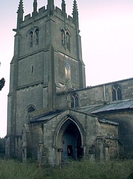
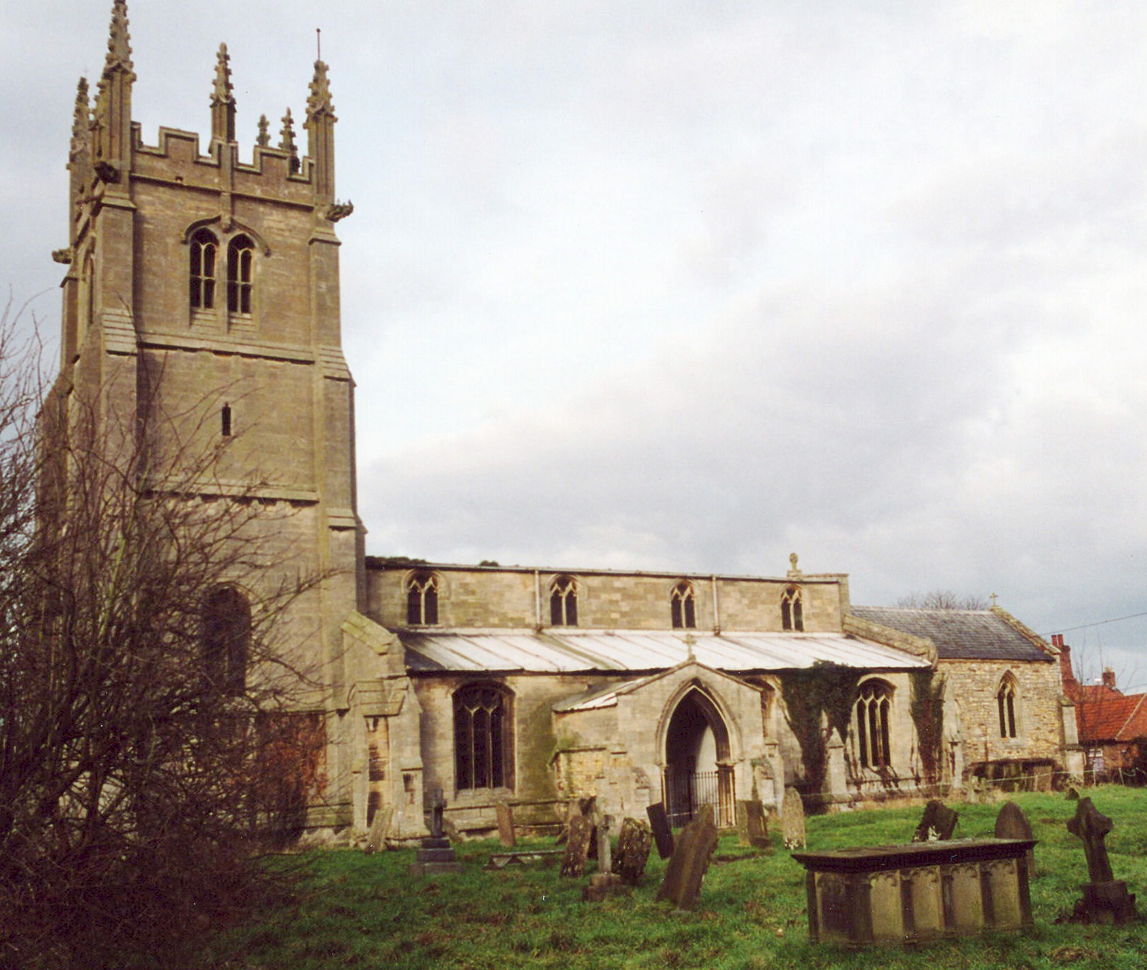
- The Anglican parish church is dedicated to All Saints.
- The church is of the Gothic style.
- The church was restored in 1857, then again in 1888 and 1900.
- A new clock, to replace the old one, was presented by the Rev. A. F. SUTTON in 1899. The old clock was said to date from the reign of Elizabeth I.
- The church seats about 360 persons.
- A grant was received in 2002 to restore the churchyard and reseat many of the headstones.
- Bob DANYLEC has a photograph of All Saints Church on Geo-graph, taken in November, 2005.
- Here is a photo of the church, taken by (and copyright of) Wendy PARKINSON.

- Here is a photo of the church, taken by Ron COLE (who retains the copyright):

- The parish register dates from 1558 (some sources give 1573) and the Bishop's transcripts start in 1561.
- The Lincolnshire FHS has a Loan Library service which has the parish registers on microfiche for Baptisms from 1554 to 1812 and Marriages from 1586 to 1812.
- The LFHS has published several marriage indexes for the Loveden Deanery to make your search easier.
- The Wesleyan Methodists built a small chapel here before 1896.
- For additional assistance in researching this chapel see our non-conformist religions page.
- Check our Church Records page for county-wide resources.
- The parish was in the Bassingham sub-district of the Newark Registration District.
- Check our Civil Registration page for sources and background on Civil Registration which began in July, 1837.
Beckingham is a parish and village approximately 5 miles east of Newark on Trent and ten miles SSW of Lincoln. Nottinghamshire forms the western border (the boundary is the waterway known as "Shiredyke" stream), Stapleford parish borders on the north and Fenton parish to the south. The parish covers about 2,000 acres and includes the hamlet of Sutton, about one mile south of the village of Beckingham.
The village of Beckingham lies on the east bank of the River Withern, with some houses on the west bank. If you are planning a visit:
- Take a virtual tour at the Beckingham village website.
- Take the A17 trunk road east out of Newark or west from Sleaford.
- Jonathan THACKER has a photograph of the Village Hall on Geo-graph, taken in August, 2010. You should stop in and check the schedule of forthcoming events.
- Visit our touring page for more sources.
The National Gazetteer of Great Britain and Ireland - 1868
"SUTTON, a hamlet in the parish of Beckingham, wapentake of Loveden, parts of Kesteven, county Lincoln, 10 miles N.W. of Grantham, near the river Witham."
- Ask for a calculation of the distance from Beckingham to another place.
- The STRAPPS family were millers in the mill to the north of the town in the late 1700s/early 1800s.
- And check the Loveden Org website for local history.
- In 1842 and 1868 (and again in 1900 through 1930) there were two Public Houses in Beckingham: The Black Swan and The Pack Horse.
- In 1896, the proprietor of the Black Swan was Mrs. Elizabeth Rose TAYLOR.
- The Black Swan has refocused itself as a Bistro. At last report (2013), it was for sale.
- Miss STEEL has a photograph of the 16th century Pack Horse Inn on Geo-graph, taken in 2011.
- And J. HANNAH-BRIGGS also has a photograph of the Pack Horse Inn on Geo-graph, taken in January, 2013.
- These are the names associated with the Pack Horse Inn in various directories:
| Year | Proprietor |
|---|---|
| 1842 | Wm. POGSON, vict. |
| 1868 | Mrs. Mary CLARK |
| 1872 | John James PAKES, vict. |
| 1882 | Robert BURROWS, vict. |
| 1896 | John Henry WILLIAMS |
| 1900 | John Henry WILLIAMS |
| 1913 | Mrs. Lucy WILLIAMS |
| 1930 | George WALKER |
- The principal landowners in 1871 were the Rev. George MARSLAND and the trustees of the late C. G. MILNES. Freeholders included the families JOHNSON and HANDLEY. About 155 acres belonged to Corpus Christi College, Oxford.
- See our Maps page for additional resources.
You can see maps centred on OS grid reference SK876538 (Lat/Lon: 53.074258, -0.693902), Beckingham which are provided by:
- OpenStreetMap
- Google Maps
- StreetMap (Current Ordnance Survey maps)
- Bing (was Multimap)
- Old Maps Online
- National Library of Scotland (Old Ordnance Survey maps)
- Vision of Britain (Click "Historical units & statistics" for administrative areas.)
- English Jurisdictions in 1851 (Unfortunately the LDS have removed the facility to enable us to specify a starting location, you will need to search yourself on their map.)
- Magic (Geographic information) (Click + on map if it doesn't show)
- GeoHack (Links to on-line maps and location specific services.)
- All places within the same township/parish shown on an Openstreetmap map.
- Nearby townships/parishes shown on an Openstreetmap map.
- Nearby places shown on an Openstreetmap map.
There is a wood-framed white stone tablet in the Village Hall that is the Beckingham Roll of Honour. It has 24 names, 4 of whom died.
- The name Beckingham is from the Old English Becca+inga+ham, or "homestead of the family or followers of Bassa". In 1177, the village is given as Bekingeham.
[A. D. Mills, "A Dictionary of English Place-Names," Oxford University Press, 1991]
Here's a partial list of surnames found in Beckingham in 1871:
ANDREW, CARTLEDGE, CROSBY, GIBSON, HUNT, JOHNSON, MARSLAND, PAKES, POGSON, RIMINGTON, ROBINSON, ROCKLEY, ROSSINGTON, SEWARDS, SMITH, TEBB and TORRY.
And read a few issues of the Beckingham Bugle available online as Portable Document Files (requires Adobe Reader download).
- This place was an ancient parish in Lincoln county and became a modern Civil Parish when those were established.
- The parish was in the ancient Loveden Wapentake in the North Kesteven division of the county, in the parts of Kesteven.
- You may contact the local Parish Council about civic or political issues, but they are NOT staffed to answer family history questions.
- Timothy HEATON has a photograph of the Village Hall on Geo-graph, taken in July, 2014.
- Kelly's "1913 Directory of Lincolnshire" places this parish, perhaps erroneously, in the South Kesteven division of the county.
- For today's district governance, see the North Kesteven District Council.
- Care of the poor dates back to at least 1691 when Randolph PATTINSON left to the poor the fourth part of an oxgang of land, later exchanged into gardens.
- The Common Land was enclosed here in 1770.
- Bastardy cases would be heard in the Spittlegate petty session hearings.
- After the Poor Law Amendment Act reforms of 1834, the parish became part of the Newark Poor Law Union.
- In 1878, Mrs. Dorothy B. BROWNE, of the MILNES family, left £500 with the church for the poor and educational purposes.
- A small National School was built in 1840 by the Rev. George MARSLAND for 85 students. The building was renovated in 1886. Average attendance was 55.
- Jonathan THACKER has a photograph of the former School on Geo-graph, taken in June, 2010.
- For more on researching school records, see our Schools Research page.
