Hide
Stapleford
hide
Hide
hide
Hide
hide
Hide
Hide
Hide
The Library at Newark-on-Trent will prove useful in your research.
- The parish was in the Bassingham sub-district of the Newark Registration District.
- Check our Census Resource page for county-wide resources.
- The table below gives census piece numbers, where known:
| Census Year | Piece No. |
|---|---|
| 1841 | H.O. 107 / 622 |
| 1851 | H.O. 107 / 2136 |
| 1861 | R.G. 9 / 2477 |
| 1891 | R.G. 12 / 2712 |
- In the 1086 Domesday Book the parish is noted as having a church.
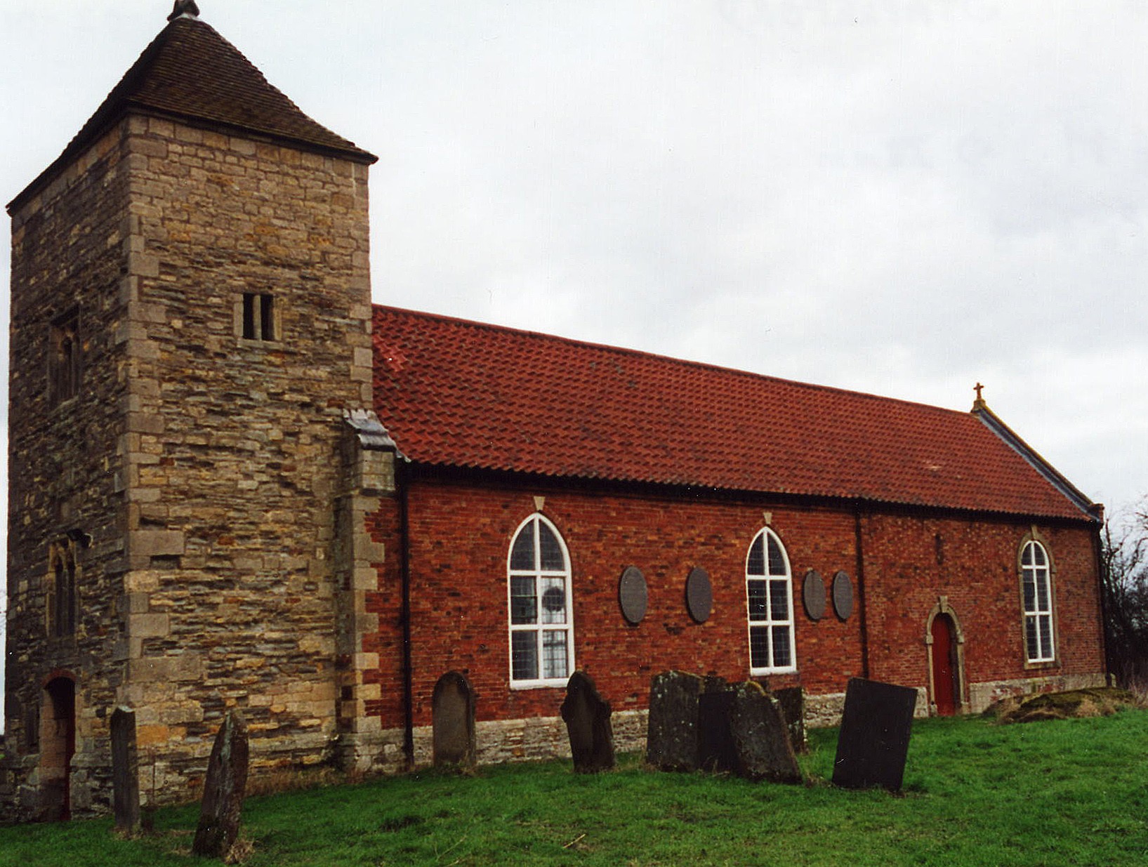
- The Anglican parish church is dedicated to All Saints.
- There is a 14th Century churchyard cross that is a Grade II structure.
- The church was rebuilt in 1770 upon the foundations of an earlier church.
- In 1871 the church did not have its own parsonage.
- The church was restored in 1903.
- The church seats 90.
- A photograph of All Saints church is at the Wendy PARKINSON Church Photo site.
- Here is a photo of All Saints Church, taken by Ron COLE (who retains the copyright):

- The parish register dates from 1695, but the Bishop's transcript goes back to 1562.
- The LFHS has published several indexes (marriage and burial) for the Graffoe Deanery to make your search easier.
- Parish registers are on file at the Society of Genealogists, covering 1663 - 1821.
- Marriages are in Boyd's Marriage Index, covering 1651 - 1809 and Pallot's Marriage Index, covering 1790 - 1809.
- Check our Church Records page for county-wide resources.
- The parish was in the Bassingham sub-district of the Newark Registration District.
- Check our Civil Registration page for sources and background on Civil Registration which started in July, 1837.
Stapleford is both a parish and a village that lies in the vale of the River Witham, 7 miles ENE of Newark and 12 miles SSW of Lincoln. The two Nottinghamshire parishes of South Collingham and Langford lie to the west, and the Lincolnshire parishes of Norton Disney and Carlton le Moorland lie to the north and east. The parish covers just over 2,700 acres of good farmland.
The River Witham passes just east of the village in its journey north. If you are planning a visit:
- By automobile, the village is just south and east off of the A46 trunk road between Lincoln and Newark.
- The A17 trunk road is about three miles to the south of the village.
- Visit our touring page for more sources.
- Ask for a calculation of the distance from Stapleford to another place.
- Flawford farm, formerly an extra-parochial plot only four miles east of Newark, is partly in Lincolnshire and mostly in Nottinghamshire. In ancient times it belonged to the Knights Templar, but by 1871 belonged to the HANDLEY family of Newark. In 1884, this farm was split between the two counties and the portion adjoining Stapleford, about 200 acres, became part of that parish.
- In 1871, all of the remaining parish land was owned by Lord Middleton. In 1913, he was still the principal landowner.
- See our Maps page for additional resources.
You can see maps centred on OS grid reference SK882577 (Lat/Lon: 53.109432, -0.683384), Stapleford which are provided by:
- OpenStreetMap
- Google Maps
- StreetMap (Current Ordnance Survey maps)
- Bing (was Multimap)
- Old Maps Online
- National Library of Scotland (Old Ordnance Survey maps)
- Vision of Britain (Click "Historical units & statistics" for administrative areas.)
- English Jurisdictions in 1851 (Unfortunately the LDS have removed the facility to enable us to specify a starting location, you will need to search yourself on their map.)
- Magic (Geographic information) (Click + on map if it doesn't show)
- GeoHack (Links to on-line maps and location specific services.)
- All places within the same township/parish shown on an Openstreetmap map.
- Nearby townships/parishes shown on an Openstreetmap map.
- Nearby places shown on an Openstreetmap map.
- The parish name occurs several places in England. It derives from the Old English stapol+ford, which means "ford marked by a post".
["A Dictionary of English Place-Names," A. D. Mills, Oxford University Press, 1991]
- The following surnames were found in the 1872 White's Directory of Lincolnshire under this parish: BAILEY, CLAY, CLAYWORTH, GEORGE, GIBSON, HOLMES, OLIVER, PADDISON, PASK and PRIESTLEY.
- The parish was in the Low division of the ancient Boothby-Graffoe Wapentake in the North Kesteven district in the parts of Kesteven.
- Around 1840, the parish was reallocated to the High division of the Boothby-Graffoe wapentake.
- In March, 1884, the parish was split, with the Nottinghamshire portion going to Barnby-in-the-Willows parish and the Lincolnshire portion to Stapleford.
- For today's district governance, see the North Kesteven District Council.
- Bastardy cases would be heard in the Lincoln South petty session hearings.
- After the Poor Law Amendment Act reforms of 1834, the parish became part of the Newark Poor Law Union in 1837.
- A public elementary school was erected here in 1867 with room for 70 children, but only about half that ever attended.
- The school was closed on 18 July 1984.
- For more on researching school records, see our Schools Research page.
