Hide
Braceborough
hide
Hide
hide
Hide
hide
Hide
Hide
hide
Hide
Hide
- The parish was in the Barnack sub-district of the Stamford Registration District.
- Check our Census Resource page for county-wide resources.
- The table below gives census piece numbers, where known:
| Census Year | Piece No. |
|---|---|
| 1841 | H.O. 107 / 615 |
| 1851 | H.O. 107 / 2094 |
| 1861 | R.G. 9 / 2314 |
| 1871 | R.G. 10 / 3310 |
| 1891 | R.G. 12 / 2554 |
| 1901 | R.G. 13 / 3022 |
- There was a chapelry of Braceborough's Anglican Church in Wilsthorpe parish for many centuries.
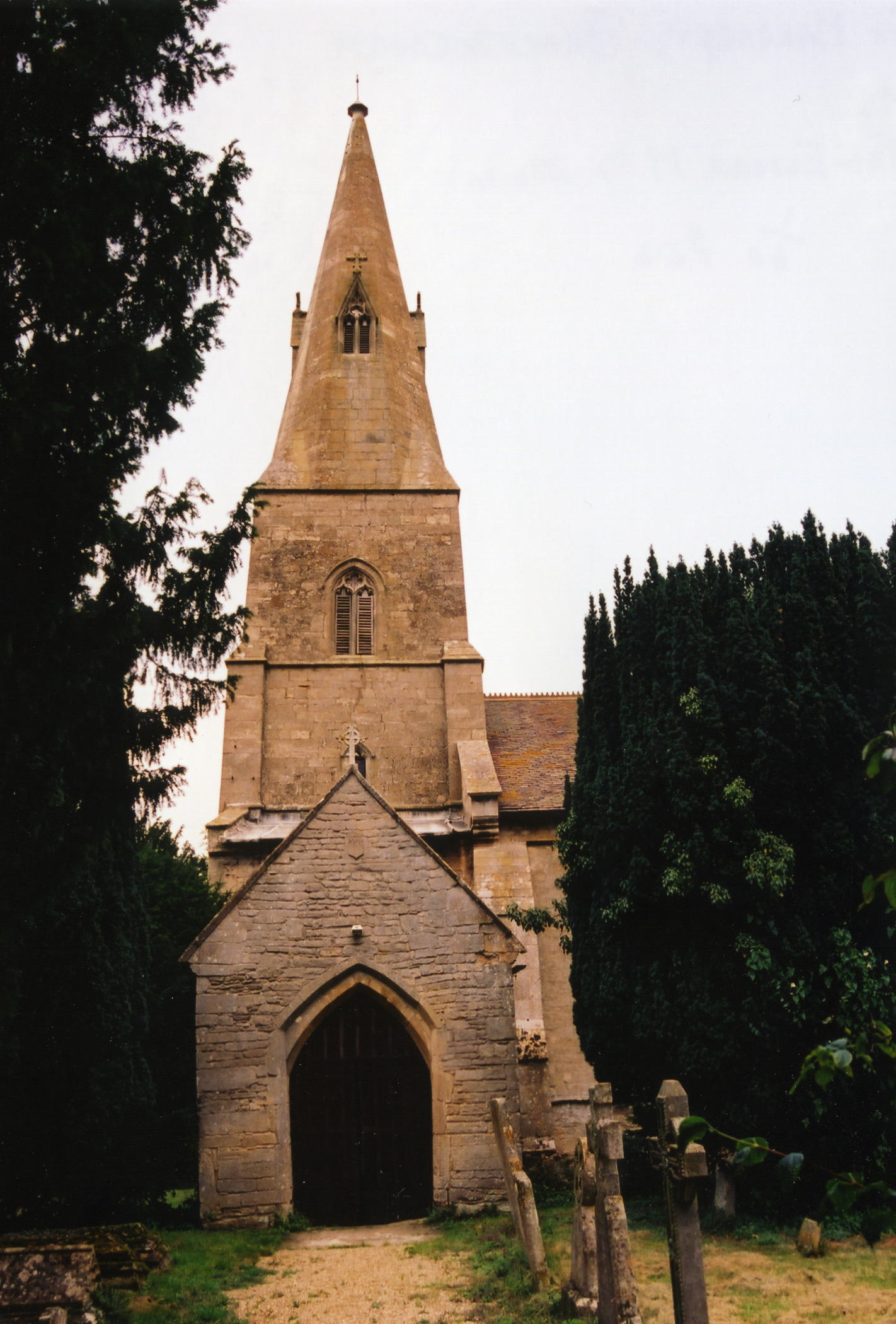
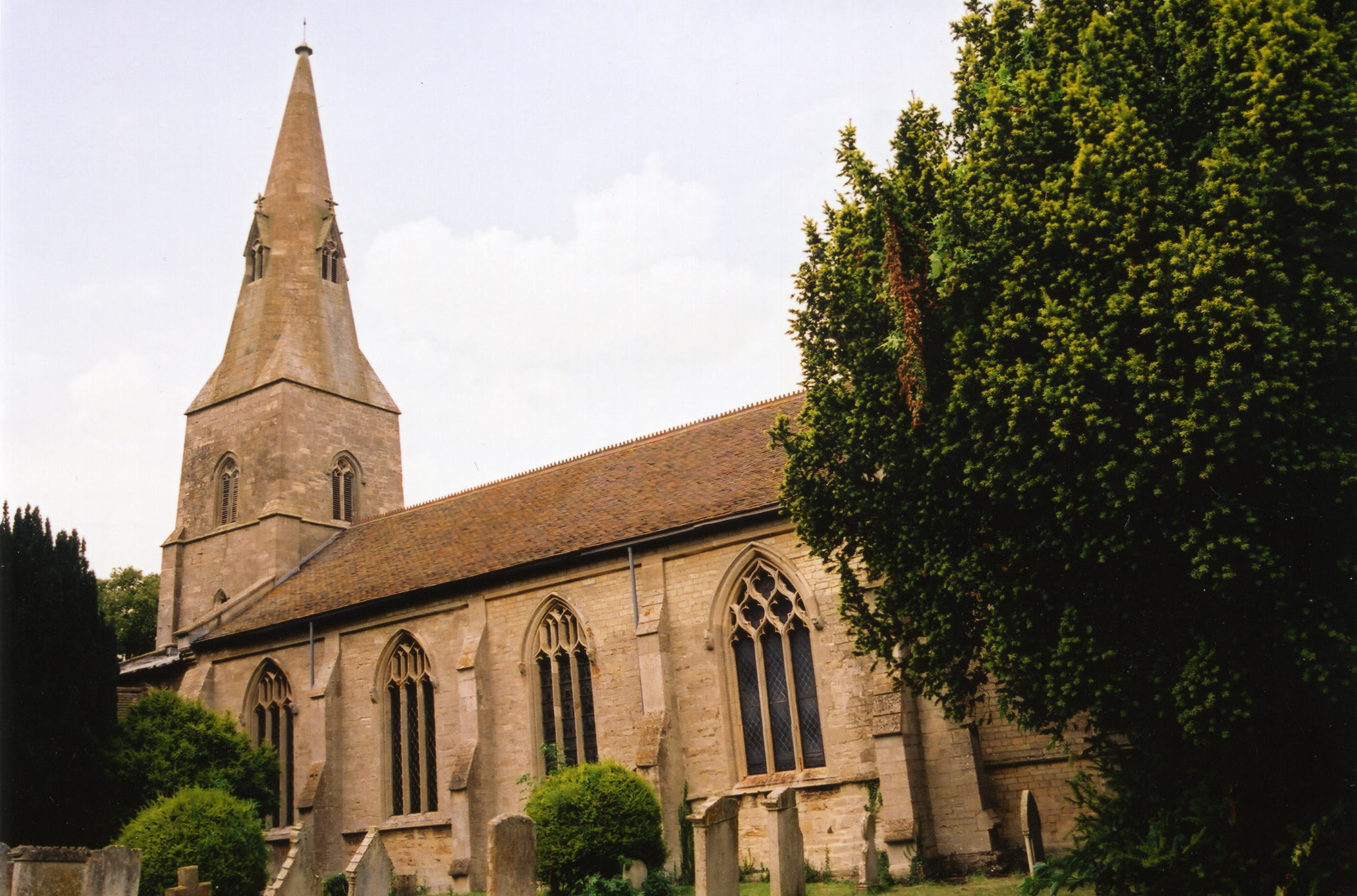
- Braceborough's Anglican Church is dedicated to Saint Margaret.
- The church underwent a thorough restoration in 1841. It was restored again in 1858.
- The church seats 130.
- There is a photograph of St. Margaret's Church on the Wendy PARKINSON Church Photos web site.
- Richard CROFT has a photograph of St. Margaret's church on Geo-graph, taken in August, 2013.
- Here are two photos of the church, taken by Ron COLE (who retains the copyright):


- Braceborough parish registers exist from 1593 but I.G.I. entries go back almost another 30 years to 1562.
- The National Burial Index (NBI) lists 261 entries (1813-1899) for the parish church.
- The Lincolnshire FHS has published several marriage indexes and a burial index for the Aveland and Ness Deanery to make your search easier.
- Check our Church Records page for county-wide resources.
- The parish was in the Barnack sub-district of the Stamford Registration District.
- Check our Civil Registration page for sources and background on Civil Registration which began in July, 1837.
Braceborough is both a village and parish 92 miles north of London, six miles northeast of Stamford and six miles northwest of Market Deeping off of either the A15 or the A16 trunk roads. The parish is bounded on the east by the River Glen and on the south by Greatford parish. To the west is Essendine parish in Rutlandshire. The parish covered about 1,700 acres in 1842.
An arm of the East Glen River runs past the north side of the village and a large wood still stands, half a mile west of the village. If you are planning a visit:
- For bus service from Stamford, see the Carlberry Bus Service site for schedules and routes.
- Stop by the Village Hall and get a schedule of current events.
- See our touring page for visitor services.
- Ask for a calculation of the distance from Braceborough to another place.
- The parish was blessed with a fine mineral spring about a mile northeast of the village and a "bathing house" was built here in 1841 for people who wanted to "take the waters".
- There was a railway station here by 1872, on the Bourne and Essendine branch of the Great Northern line.
- Braceborough History Project was published in 2000 and contains much useful information about this village. Copies are held at Stamford Public Library and Lincolnshire Archives Office. [Dereck Titchen]
- In 1842, Dr. Francis WILLIS of Shillingthorpe Hall, lord of the manor, was the principal landowner.
- In 1872 and 1882, the principal landowners were Lord Kesteven and Dr. Francis WILLIS.
- In 1900 thru 1913, the principal landowner was Lord Kesteven, lord of the manor.
- Shillingthorpe Hall, a stone mansion four miles northeast of Stamford, is in this parish. In 1842, it was occupied by Dr. Francis WILLIS, MD, who ran a private lunatic asylum in the mansion.
- In 1872, Shillingthorpe Hall was the residence of Charles PHILLIPS.
- In 1882, Shillingthorpe Hall was unoccupied.
- In 1900, Shillingthorpe Hall was occupied by Mrs. MAPLETON.
- In 1913, Shillingthorpe Hall was unoccupied.
- See our Maps page for additional resources.
You can see maps centred on OS grid reference TF080131 (Lat/Lon: 52.704806, -0.403021), Braceborough which are provided by:
- OpenStreetMap
- Google Maps
- StreetMap (Current Ordnance Survey maps)
- Bing (was Multimap)
- Old Maps Online
- National Library of Scotland (Old Ordnance Survey maps)
- Vision of Britain (Click "Historical units & statistics" for administrative areas.)
- English Jurisdictions in 1851 (Unfortunately the LDS have removed the facility to enable us to specify a starting location, you will need to search yourself on their map.)
- Magic (Geographic information) (Click + on map if it doesn't show)
- GeoHack (Links to on-line maps and location specific services.)
- All places within the same township/parish shown on an Openstreetmap map.
- Nearby townships/parishes shown on an Openstreetmap map.
- Nearby places shown on an Openstreetmap map.
For a photograph of the Braceborough War Memorial plaque in the church and the name inscribed on it, see the Roll of Honour site.
- The name Braceborough is from the Old English Braesen+burh, or "Strong fortress". In the 1086 Domesday Book, the village is given as Braseborg". You may also find it in old records as "Braceburg(h)".
[A. D. Mills, "A Dictionary of English Place-Names," Oxford University Press, 1991]
- White's 1842 Directory lists the following names in the parish: John BERRIDGE, Robt. BLACKLOCK, John FARROW, James FRANCIS, Joseph FRANCIS, Wm. HEWITT, George HILL, Samuel JUDSON, Jonathan MOYER, Samuel PARKINSON, Jas. QUINCY, Rev. Geo. ROGERS, John ROLLINGSON, William SMITH, William TURNELL and Dr. Francis WILLIS.
- White's 1872 Directory lists the following surnames in the parish: BARSBY, BERRIDGE, CAMM, FRAZER, HUXLEY, JACKSON, KNIPE, MITCHELL, MOUNTAIN, PHILLIPS, PRATT, QUINCY, SHERMAN, SMITH, STEDALL, TURNILL and WILLIS.
- White's 1882 Directory lists the following surnames in the parish: AULT, BARSBY, BERRIDGE, CAMM, DOWNS, FRISBY, HUXLEY, KNIPE, MOUNTAIN, QUINCEY, SMITH, STORY, TURNILL, WILLIS and WOOLLEY.
- Kelly's 1900 Directory lists the following surnames in the parish: BARSBY, BLUNT, DOWNS, FENTON, HARVEY, HAWKES, MAPLETON, SMITH, SNEATH, STORY, TURNILL, WILLIS and WOOLLEY.
- Kelly's 1913 Directory lists the following surnames in the parish: ANDREW, BARSBY, CUNNINGTON, PAINE, SMITH, STORY, WHATTOFF and WOOLLEY.
- This place was an ancient parish in Lincoln county and became a modern Civil Parish when those were established.
- The parish was in the ancient Ness Wapentake in the South Kesteven district in the parts of Kesteven.
- For today's district governance, contact the South Kesteven District Council.
- Bastardy cases were heard in the Bourne petty session hearings.
- As a result of the 1834 Poor Law Amendment Act, the parish became part of the Stamford Poor Law Union.
- In 1871 a schoolhouse was built, attended at that time by about 35 students.
- Kelly's 1913 Directory tells us that the children of the parish attended school at Greatford.
- For more on researching school records, see our Schools Research page.
