Hide
Cumberworth
hide
Hide
hide
Hide
hide
Hide
Hide
Hide
The Community Library at Alford has a local history archive that will prove useful in your research.
- The parish was in the Alford sub-district of the Spilsby Registration District.
- The North Lincolnshire Library at Scunthorpe holds copies of the 1841 and 1881 census returns for Cumberworth.
- Check our Census Resource page for county-wide resources.
- The table below gives census piece numbers, where known:
Census
YearPiece No. 1841 H.O. 107 / 631 1851 H.O. 107 / 2110 1861 R.G. 9 / 2378 1871 R.G. 10 / 3396 1891 R.G. 12 / 2605
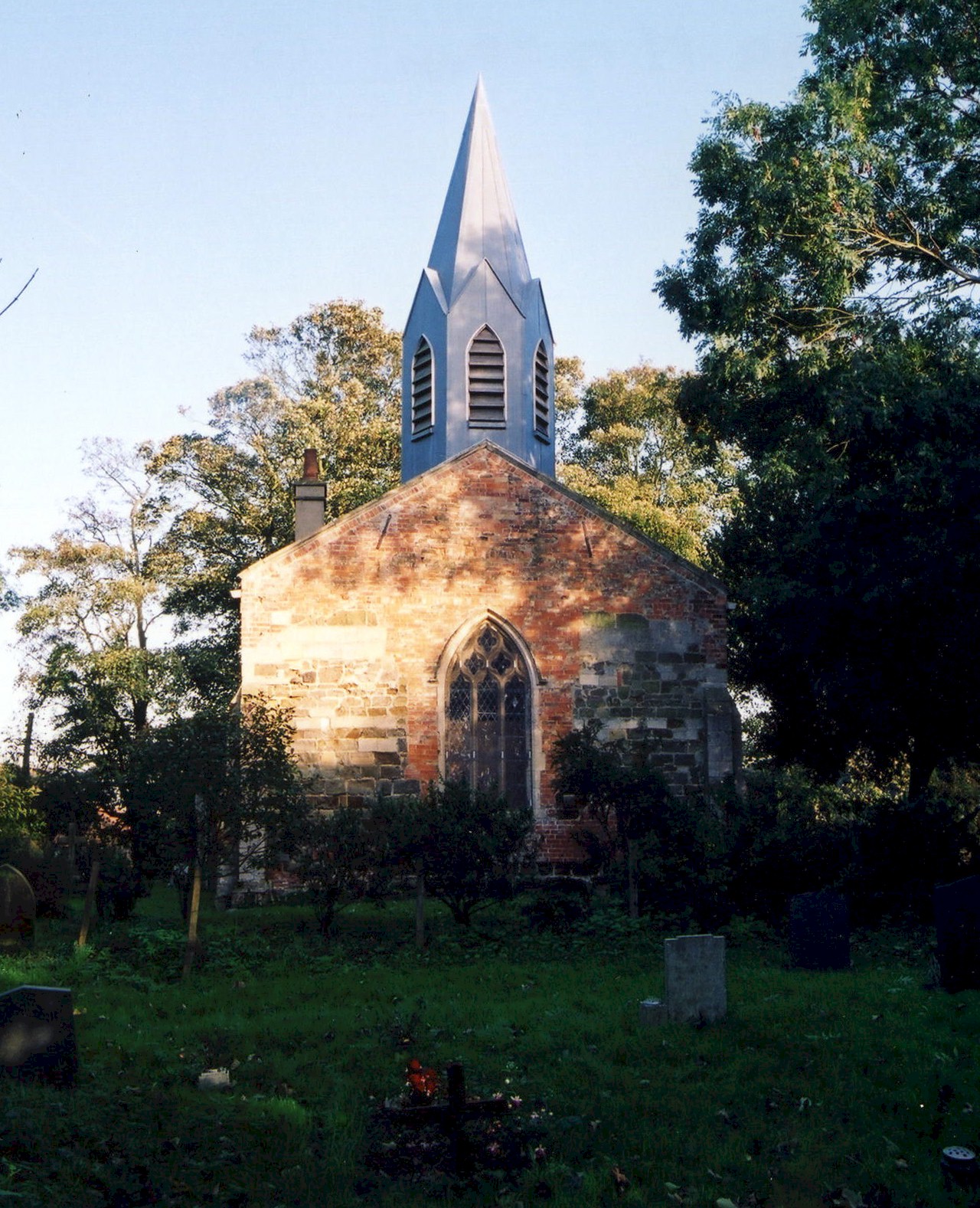
- The Anglican parish church is dedicated to Saint Helen.
- In 1870 the church was reseated and partially restored.
- In 1899 a new Vestry was added to the church.
- The church is a Grade II Listed Building with British Heritage.
- The church seats 120.
- The Diocese of Lincoln declared this church redundant in February, 1987. It was sold for residential use in 1989.
- Here is a photo of the church, taken by Ron COLE (who retains the copyright):

- The Anglican church registers are on deposit from 1557 and the registers are available on microfilm from the Family History Library (FHL).
- The Lincolnshire FHS has published several marriage indexes and a burial index for the Calcewaith and Candleshoe Deanery to make your search easier.
- The Wesleyan Methodists and Primitive Methodists built chapels here in the 1800's.
- For information and assistance in researching these independent chapels, see our non-conformist religions page.
- Check our Church Records page for county-wide resources.
- The parish was in the Alford sub-district of the Spilsby Registration District.
- Check our Civil Registration page for sources and background on Civil Registration which began in July, 1837.
Cumberworth (alternately "Cumberwerth") is both a village and a parish which lie about five miles south-east of Alford and about ten miles north-north-west of Skegness. It is only about 1,274 acres, with Farlesthorpe and Mumby parishes to the north, Willoughby parish to the south and west and Hogsthorpe parish to the east.
If you plan to visit Cumberworth village:
- Take the A52 north out of Skegness and turn left at Mumby.
- For information on visiting, see the Lincolnshire Touring and Holidays page on this site.
- Ask for a calculation of the distance from Cumberworth to another place.
- The village is listed in the 1086 Domesday Book with 9 households.
- In 1415, and again in 1431, Thomas CUMBERWORTH of Cumberworth was Sheriff of Lincolnshire.
- See our Maps page for additional resources.
You can see maps centred on OS grid reference TF506735 (Lat/Lon: 53.237534, 0.255432), Cumberworth which are provided by:
- OpenStreetMap
- Google Maps
- StreetMap (Current Ordnance Survey maps)
- Bing (was Multimap)
- Old Maps Online
- National Library of Scotland (Old Ordnance Survey maps)
- Vision of Britain (Click "Historical units & statistics" for administrative areas.)
- English Jurisdictions in 1851 (Unfortunately the LDS have removed the facility to enable us to specify a starting location, you will need to search yourself on their map.)
- Magic (Geographic information) (Click + on map if it doesn't show)
- GeoHack (Links to on-line maps and location specific services.)
- All places within the same township/parish shown on an Openstreetmap map.
- Nearby townships/parishes shown on an Openstreetmap map.
- Nearby places shown on an Openstreetmap map.
- The name Cumberworth derives from Old English Cumbre+worth, or "enclosure of a man called Cumbra, or of the Britons". It appeared in the 1086 Domesday Book as Cumbreuorde.
[A. D. MILLS, "A Dictionary of English Place-Names," Oxford University Press, 1991]
- This place was an ancient parish in Lincoln county and becme a modern Civil Parish when those were established.
- The parish was in the ancient Calceworth Wapentake in the East Lindsey district in the parts of Lindsey.
- Kelly's 1900 Directory of Lincolnshire reports, perhaps erroneously, that the parish was in the South Lindsey division of the county.
- For today's district governance, see the East Lindsey District Council.
- Bastardy cases would be heard in the Alford petty session hearings on alternate Tuesdays.
- The Common Lands were enclosed here circa 1800 (the 41st year of George III).
- As a result of the 1834 Poor Law Amendment Act, the parish became part of the Spilsby Poor Law Union.
- Around 1895, Joseph Waite HART left £150 in government securities. The interest from this went to the parish poor.
- The poor also have 5 acres of land set aside for their use.
- A National School was built here in 1874 for 60 children.
- It is reported that the children of the parish attended a school in Memby parish.
- See our Schools page for more information on researching school records.
