Hide
Grainsby
hide
Hide
hide
Hide
hide
Hide
Hide
hide
- Maps
- Migration, Internal◬
- Military History◬
- Military Records◬
- Names, Geographical◬
- Names, Personal◬
- Naturalisation & Citizenship◬
- Newspapers◬
- Occupations◬
- Officials & Employees
- Politics & Government
- Poor Houses, Poor Law
- Population
- Postal & Shipping Guides◬
- Probate Records◬
- Public Records◬
- Schools
- Societies◬
- Voting Registers◬
Hide
"GRAINSBY, a parish in the hundred of Bradley Haverstoe, parts of Lindsey, county Lincoln; 6 miles S. of Great Grimsby, its post town, and 8 N.W. of Louth. The North Thoresby station on the Boston and Great Grimsby branch of the Great Northern railway is 3 miles S.W. of the village, which is very small. The tithes have been commuted for a rent-charge of £254 10s. The living is a rectory* in the diocese of Lincoln, value £285. The church is dedicated to St. Nicholas. Grainsby Hall, a handsome mansion, situated in an extensive park and beautiful pleasure-grounds, is the principal residence."
[Transcribed from The National Gazetteer of Great Britain and Ireland 1868]
by Colin Hinson ©2020
Hide
The Library at Louth will prove useful in your research.
Ian S. has a photograph of a potion of the churchyard on Geo-graph, taken in September, 2014.
- The parish was in the Tetney sub-district of the Louth Registration District.
- Check our Census Resource page for county-wide resources.
- The table below gives census piece numbers, where known:
| Census Year | Piece No. |
|---|---|
| 1841 | H.O. 107 / 635 |
| 1861 | R.G. 9 / 2387 |
| 1871 | R.G. 10 / 3410 |
| 1881 | R.G. 11 / 3266 |
| 1891 | R.G. 12 / 2611 |
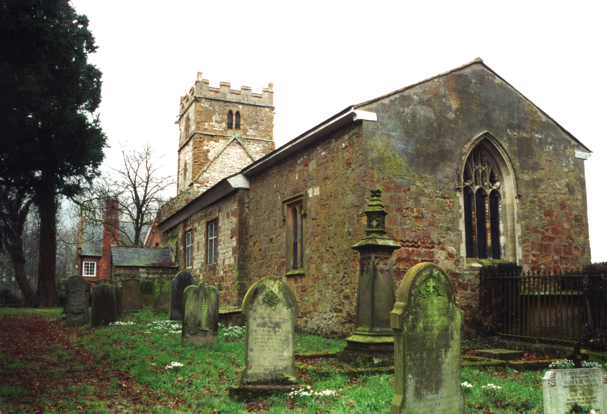
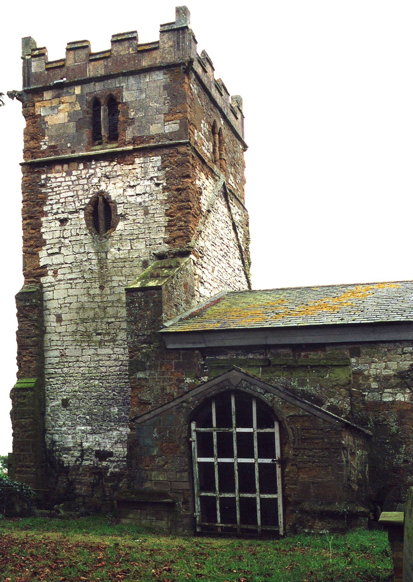
- The Anglican parish church is dedicated to Saint Nicholas.
- The church has scorchmarks, reputedly caused by the Danes on one of their invasions. Parts of the church tower date from before the advent of William the Conquerer, but the structure appears to be Norman.
- The church seats 120.
- Jon HOLLAND has a photograph of St. Nicholas Church on Geo-graph, taken in June, 2008.
- Bob EMM has a photograph of the church interior on Geo-graph, taken in July, 2008.
- Here are two photos of Saint Nicholas Church, taken by (and copyright of) Ron COLE.


- The Anglican parish register dates from 1561.
- The London Family History Centre has copies of the Bishop's Transcripts for 1561 thru 1844.
- The Lincolnshire FHS has published several marriage indexes and a 1641/2 Protestation Return for the Haverstoe Deanery to make your search easier.
- The church has also been in the South Grimsby rural Deanery.
- The Wesleyan Methodists built a chapel here in 1860.
- For more on this chapel and their records, check our Non-Conformist Church Records page for additional resources.
- Bob EMM has a photograph of the former Methodist Chapel on Geo-graph, taken in June, 2013. It is now a private residence.
- Ian S. also has a photograph of the Former Wesleyan Chapel on Geo-graph, taken in September, 2014.
- Check our Church Records page for county-wide resources.
- The parish was in the Tetney sub-district of the Louth Registration District.
- Check our Civil Registration page for sources and background on Civil Registration which began in July, 1837.
This parish and small village sits about 7 miles south of Grimsby. Waithe parish lies to the north and Tetney parish to the north-east. The parish covers about 1,200 acres.
If you are planning a visit:
- By automobile, take the A16 trunk road south out of Grimsby for about 7 miles.
- See our touring page for visitor services.
The National Gazetteer of Great Britain and Ireland - 1868
"GRAINSBY, a parish in the hundred of Bradley Haverstoe, parts of Lindsey, county Lincoln; 6 miles S. of Great Grimsby, its post town, and 8 N.W. of Louth. The North Thoresby station on the Boston and Great Grimsby branch of the Great Northern railway is 3 miles S.W. of the village, which is very small. The tithes have been commuted for a rent-charge of £254 10s. The living is a rectory* in the diocese of Lincoln, value £285. The church is dedicated to St. Nicholas. Grainsby Hall, a handsome mansion, situated in an extensive park and beautiful pleasure-grounds, is the principal residence."
- Ask for a calculation of the distance from Grainsby to another place.
- Grainsby Hall was built starting in 1086 just west of the village off of Grainsby Lane.
- The Hall was rebuilt in the Italianate style in 1860.
- Grainsby Hall was occupied by George Henry Caton HAIGH from 1900 through 1912.
- Grainsby Hall was requisitioned by the Army during WW2 and fell into disrepair afterwards when maintenance costs had become unsustainable.
- The Hall was demolished in February 1973. The walls of the garden are still in place.
- See our Maps page for additional resources.
You can see maps centred on OS grid reference TF278995 (Lat/Lon: 53.477064, -0.076132), Grainsby which are provided by:
- OpenStreetMap
- Google Maps
- StreetMap (Current Ordnance Survey maps)
- Bing (was Multimap)
- Old Maps Online
- National Library of Scotland (Old Ordnance Survey maps)
- Vision of Britain (Click "Historical units & statistics" for administrative areas.)
- English Jurisdictions in 1851 (Unfortunately the LDS have removed the facility to enable us to specify a starting location, you will need to search yourself on their map.)
- Magic (Geographic information) (Click + on map if it doesn't show)
- GeoHack (Links to on-line maps and location specific services.)
- All places within the same township/parish shown on an Openstreetmap map.
- Nearby townships/parishes shown on an Openstreetmap map.
- Nearby places shown on an Openstreetmap map.
George Henry Caton HAIGH, mentioned in the Manors section above, became High Sheriff of Lincolnshire in 1912.
- This place was an ancient parish in Lincoln county and became a modern Civil Parish when those were established.
- The parish was in the ancient Bradley Haverstoe Wapentake in the East Lindsey district in the parts of Lindsey.
- The parish is part of the "North Thoresby, Grainsby and Waithe Parish Council".
- You may contact the Group Parish Council regarding civic or politiacl issues, but they are NOT staffed to assist you with family history searches.
- For today's district governance, see the East Lindsey District Council.
- Bastardy cases were heard in the Grimsby petty sessions every other Thursday.
- The parish was entitled to send one poor person to the almshouses at Ashby-cum-Fenby.
- After the 1834 Poor Law Amendment Act reforms, the parish became part of the Louth Poorlaw Union.
- The children of this parish attended a school in North Thoresby parish.
- For more on researching school records, see our Schools Research page.
