Hide
Harpswell
hide
Hide
hide
Hide
hide
Hide
Hide
[Transcribed from The National Gazetteer of Great Britain and Ireland 1868]
by Colin Hinson ©2020
Hide
You may want to visit The Gainsborough Heritage Centre for assistance with your search.
- Ian S. has a photograph of St. Chad's churchyard on Geo-graph, taken in May, 2018.
- John SUTTON has a photograph of the gravestone of Thomas and Helen TATHAM, both of whom died in their eighties in 1904. Photo taken in June, 2016.
- The parish was in the Willingham sub-district of the Gainsborough Registration District.
- In the 1891 re-organisation, the parish was allocated to the Marton subdistrict of the Gainsborough Registration District.
- The North Lincolnshire Library holds a copy of the parish census returns for 1841 through 1901.
- Check our Census Resource page for county-wide resources.
- Below are the census Piece Numbers, where known:
| Census Year | Piece Numbers |
|---|---|
| 1841 | H.O. 107 / 635 & 636 |
| 1861 | R.G. 9 / 2410 |
| 1871 | R.G. 10 / 3448 |
| 1891 | R.G. 12 / 2636 |
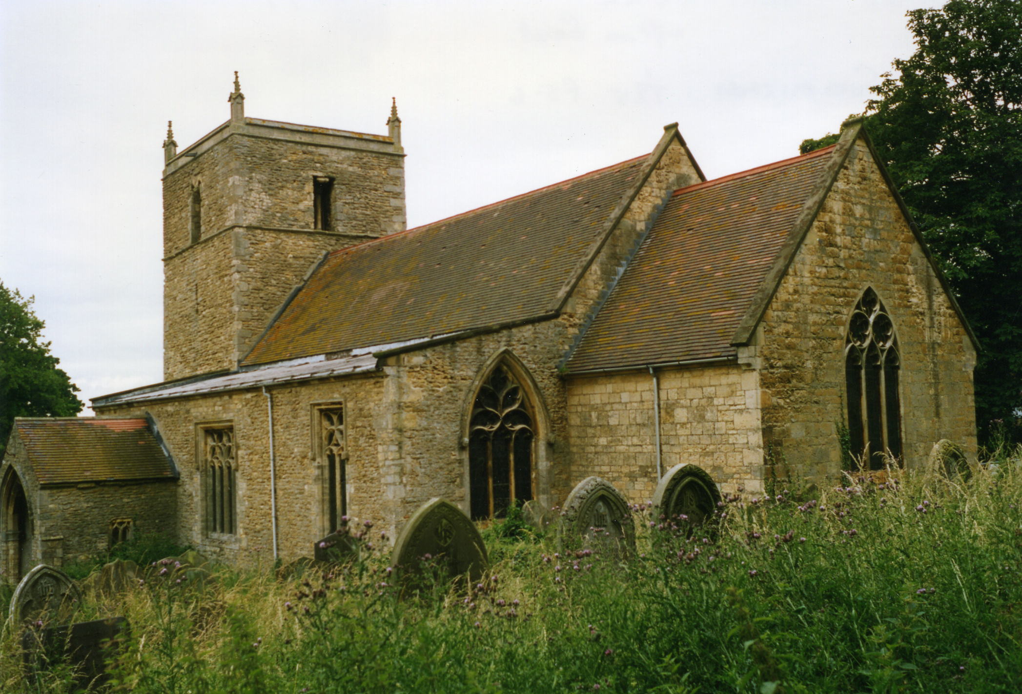
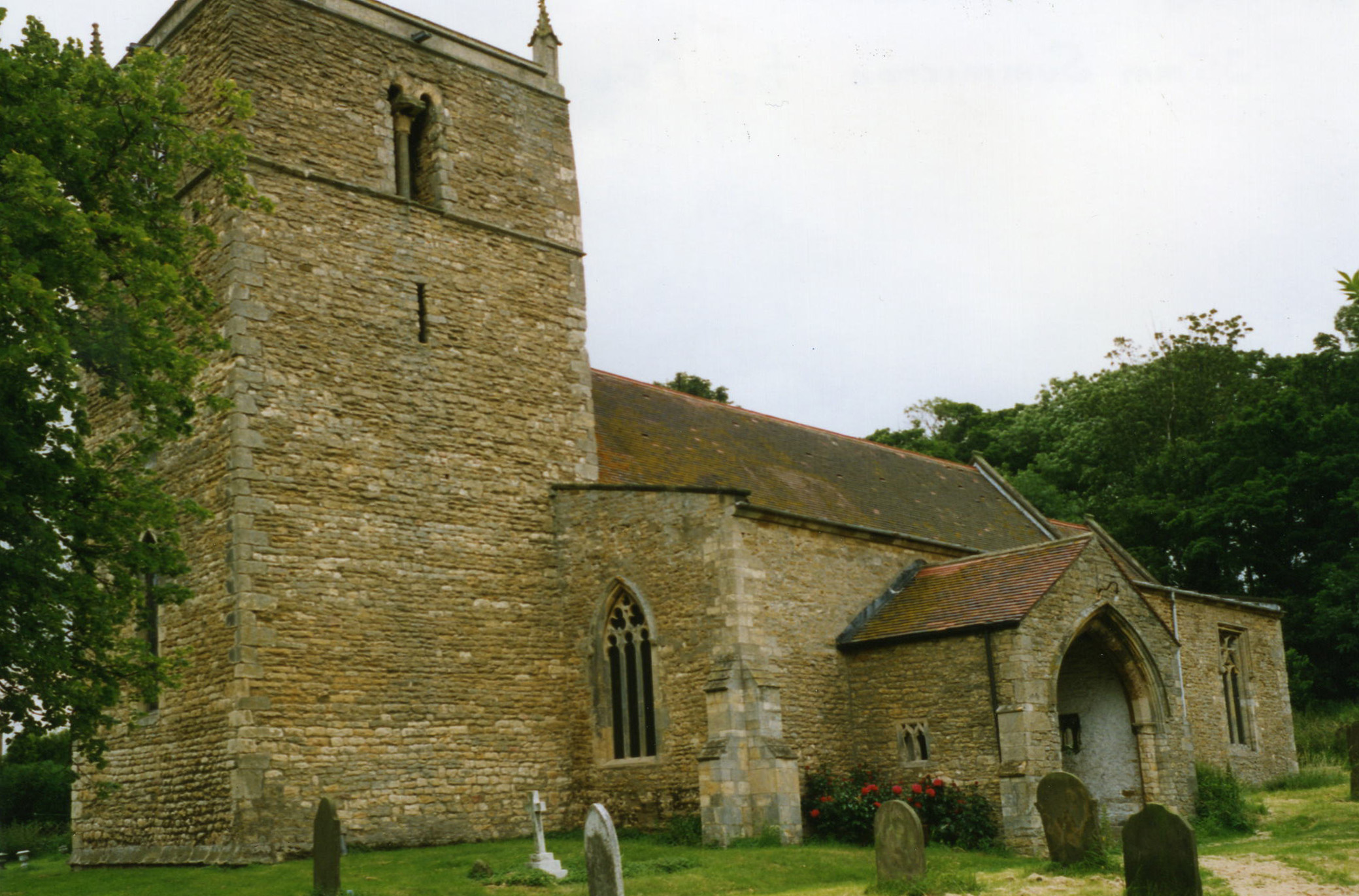
- The Anglican parish church is dedicated to Saint Chad of Mercia.
- The church partially dates back to the Norman era. The church was restored in 1890-91.
- In the basement of the church is a large stone slab bearing the figure of a priest. It has an undated Norman French inscription to John GERE, parson of Harpperswelle.
- The church contains a monument to William de HARRINGTON, rector here circa 1346. There is also a memorial to a W. HARRINGTON, rector, who died in 1697.
- In the chancel is a monument to William TYRWHITT, esq., dated 1599.
- In the churchyard is a monument to: Thomas BULCOCKE clerk, Minister of this town 38 years. Died 10 May 1633. And to: Hanvard BULCOCKE was Minister in 1634 and died 13 Oct 1669.
- The church seats 200.
- It's a SIGN! of the church, sometimes overgrown by ivy. Photo taken in April, 2011.
- Sheila FENTON has provided a photograph of the church on the Wendy PARKINSON web site.
- Here are two photographs of Saint Chad's Church, taken by Ron COLE (who retains the copyright):


- Parish registers exist from 1559, but the Bishop's transcripts only go back to 1595.
- The North Lincolnshire Library holds a copy of the parish register entries for baptisms 1559-1812, burials 1559-1812 and marriages 1559-1842.
- The Lincolnshire FHS has published several marriage and burial indexes for the Corringham Deanery to make your search easier.
- Check our Church Records page for county-wide resources.
- The parish was in the Willingham sub-district of the Gainsborough Registration District.
- In the 1891 re-organisation, the parish was allocated to the Marton subdistrict of the Gainsborough Registration District.
- Check our Civil Registration page for sources and background on Civil Registration which began in July, 1837.
Harpswell is both a parish and a small village about eight miles east of Gainsborough and nine miles north of Lincoln. The parish itself is bordered on the north by Hemswell parish, to the east by Springthorpe and Heapham parishes and to the south by Glentworth parish. The parish covers about 2,150 acres.
Harpswell village sits at the intersection of two main roads. A small branch of the River Eau passes just to the west of the village. If you are planning a visit:
- The village can be found at the intersection of the A631 trunk road east of Gainsborough and the B1398 north out of Lincoln. If coming north out of Lincoln, it is probably best to take the A15 to the A631 and turn east for one mile, but you'll miss some beautiful scenery.
- J. THOMAS provides a peaceful scene of grazing on Geo-graph, taken in September, 2012.
- Richard CROFT has a photograph of the Village Sign on Geo-graph, taken in November, 2009.
- Visit our touring page for more sources.
The National Gazetteer of Great Britain and Ireland - 1868
- Ask for a calculation of the distance from Harpswell to another place.
- In 1842, there were only seven farms covering the entire parish, except for the village. The sole landowner was Sir Thomas WHICHCOTE of Aswarby. A branch of his family used to reside here.
- In 1872, there were the same seven farms. The sole landowner was still Sir Thomas WHICHCOTE of Aswarby.
- In 1900 and 1913, the sole landowner of the parish was Sir George WHICHCOTE, baronet.
- See our Maps page for additional resources.
You can see maps centred on OS grid reference SK935901 (Lat/Lon: 53.399554, -0.595579), Harpswell which are provided by:
- OpenStreetMap
- Google Maps
- StreetMap (Current Ordnance Survey maps)
- Bing (was Multimap)
- Old Maps Online
- National Library of Scotland (Old Ordnance Survey maps)
- Vision of Britain (Click "Historical units & statistics" for administrative areas.)
- English Jurisdictions in 1851 (Unfortunately the LDS have removed the facility to enable us to specify a starting location, you will need to search yourself on their map.)
- Magic (Geographic information) (Click + on map if it doesn't show)
- GeoHack (Links to on-line maps and location specific services.)
- All places within the same township/parish shown on an Openstreetmap map.
- Nearby townships/parishes shown on an Openstreetmap map.
- Nearby places shown on an Openstreetmap map.
- Nearby RAF Hemswell was called Harpswell airfield when it first opened in 1916.
- Richard CROFT provides a photograph of the RAF graves in the churchyard on Geo-graph, taken in March, 2009.
- Although we are not sure of the relationship to Harpswell, there's a photograph of a Culloden Memorial, also, taken by Richard CROFT in March, 2009.
- David HITCHBORNE provides a photograph of the Roll of Honour in the church on Geo-graph, taken in 2004. Unfortunately, the names are difficult to discerne. The Roll is for WWII.
The following Commonwealth War Graves can be found in St. Chad's churchyard:
- John Frederick Edward ANDREWS, RAF 144 Sqdn.
- William BROWN, REF, cprl.
- Royston Henry BULLARD-DAVIES, RAF 144 Sqdn.
- David BURNSIDE, RAF 144 Sqdn.
- Eric Godfrey CLARK, RAF 144 Sqdn.
- Thomas Emlyn DAVIES, RAFVR 226 Sqdn.
- Brian Holmes FOSTER, RAF 144 Sqdn.
- Charles William GLOVER, RAF 61 Sqdn.
- Ronald GUEST, RAFVR 61 Sqdn.
- Richard Spencer Castle IVATT, RAFVR 61 Sqdn.
- Ronald JOLLY, RAF 144 Sqdn.
- Terence Denis LEITCH, RAFVR 144 Sqdn.
- John Basil MAYS, sapper, Royal Engineers
- Alexander MONCRIEFF, RAF Lt. 61 Sqdn.
- John Grgory O'GORMAN, RCAF, Srgt.
- George Edward PALMER, RAFVR
- Stanley SMITH, RAFVR 150 sqdn.
- Joseph John WATTS, RAF 144 Sqdn.
- James WINDSOR, RAF 144 Sqdn.
- Alexander WINSTANLEY, srgt. RAF 144 Sqdn.
- The name Harpswell comes from the Old English Hearpe+wella or Hearpere+wella for "spring or stream of the harp or harp player". The name appears in the 1086 Domesday Book as Herpeswella. The name is recorded in some records as Harpperswell.
Anthony D. MILLS, "A Dictionary of English Place-Names," Oxford University Press, 1991.
- White's 1842 Directory lists the following names in the parish: Jno. BROWN, Godfrey JARVILL, Jno. OGELSBY, Richard OGELSBY, Thos. RANBY, John SMITH and Wm. WARD.
- White's 1872 Directory lists the following names in the parish: Christopher F. HALL, George CASSWELL, John Thomas HOLMES, John OGELSBY, Richard OGELSBY, William STEVENSON, Thomas TATAM and Samuel TURNER.
- Kelly's 1900 Directory lists the following names in the parish: Coggon BRUMBY, Frederick Wm. TATAM, Thomas TATAM, Thomas TURNER and John WRIGHT.
- Kelly's 1913 Directory lists the following names in the parish: Coggon BRUMBY, Charles TATAM, Frederick W. TATAM, John TATAM and Thomas TURNER.
- This place was an ancient parish in Lincoln County and became a modern Civil Parish when those were established.
- The parish was in the ancient Wapentake of Aslacoe in the West Lindsey district in the parts of Lindsey.
- Parish council
- Today's district governance is provided by the West Lindsey District Council.
- Bastardy cases would be heard in the Gainsborough petty session hearings.
- As a result of the 1834 Poor Law Amendment Act, this parish became part of the Gainsborough Poorlaw Union.
- The children of this parish attended school in Hemswell.
- For more on researching school records, see our Schools Research page.
