
Hide
Melton Ross
hide
Hide
hide
Hide
hide
Hide
Hide
hide
Hide
Hide
The Brigg Library is an excellent resource with a Local History section.
- The parish was in the Brigg sub-district of the Glanford Brigg Registration District.
- Check our Census Resource page for county-wide resources.
- The table below gives census piece numbers, where known:
| Census Year | Piece No. |
|---|---|
| 1841 | H.O. 107 / 640 |
| 1861 | R.G. 9 / 2399 |
| 1871 | R.G. 10 / 3430 |
| 1891 | R.G. 12 / 2626 |
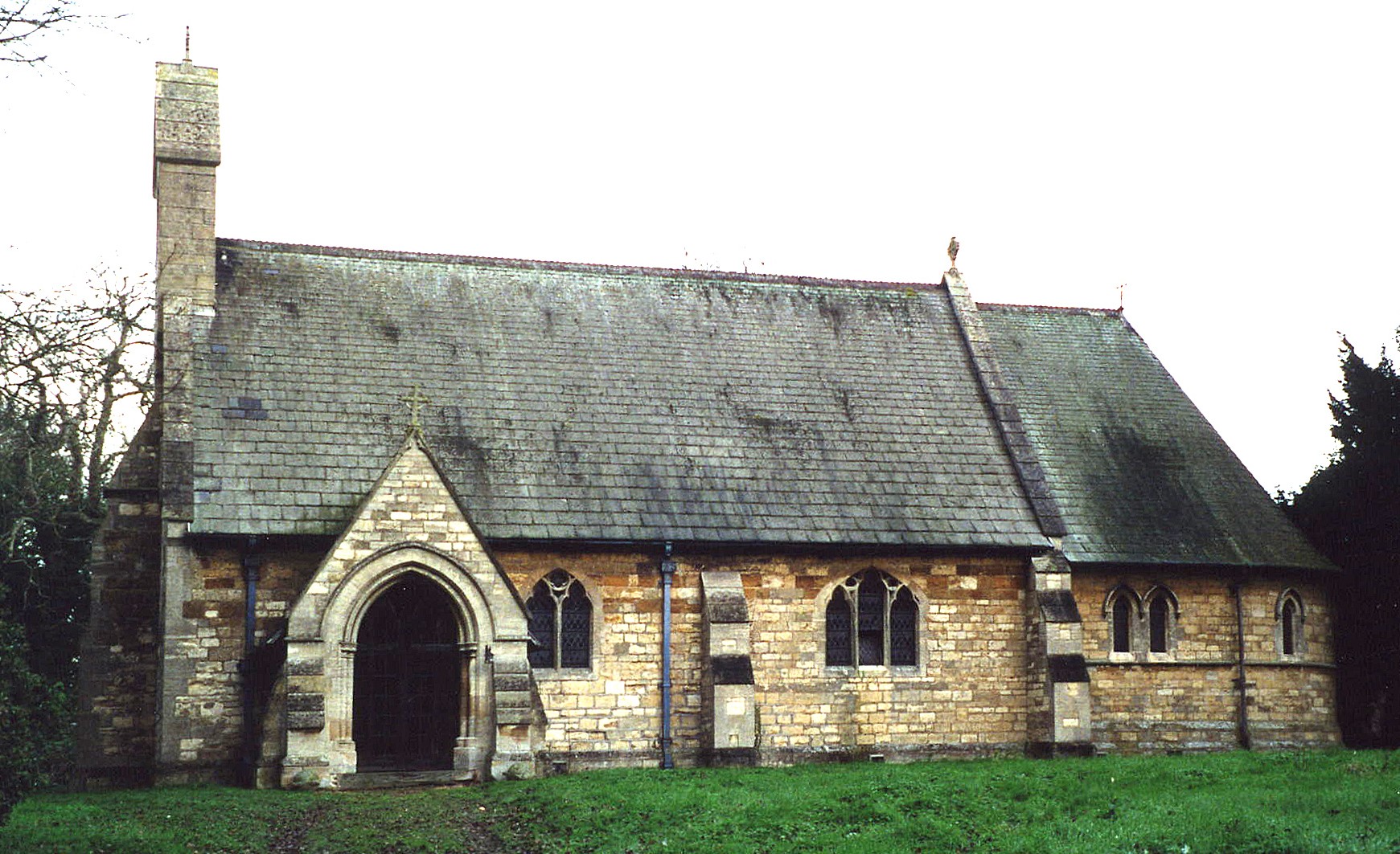
- The Anglican parish church is dedicated to the Holy Ascension.
- The church was built in 1773 to replace an older church.
- The church was rebuilt in 1867 after a fire damaged the church.
- The church seats 176 people.
- Paul GLAZZARD has a photograph of the Ascension Church on Geo-graph, taken in 2008.
- Here is a photo of Holy Ascension Church, taken by Ron COLE (who retains the copyright):
- The Anglican parish register dates from 1568.
- The Lincolnshire FHS has published several marriage indexes and a burial index for the Yarborough Deanery to make your search easier.
- There was a Privitive Methodist chapel in the hamlet of New Barnetby, built in 1854. That chapel is no longer used for religious purposes.
- David WRIGHT has a photograph of the Primitive Methodist chapel on Geo-graph, taken in 2008.
- For more on researching these chapel records, see our non-conformist religions page.
- Check our Church Records page for county-wide resources.
- The parish was in the Brigg sub-district of the Glanford Brigg Registration District.
- Check our Civil Registration page for sources and background on Civil Registration which began in July, 1837.
Melton Ross is 166 miles north of London, 16 miles inland from the mouth of the River Humber and 5 miles east of Brigg. New Barnetby is a hamlet partially in the parish and partially in Barnetby-le-Wold parish. The parish is considered a small agricultural parish. It covers about 1,800 acres.
If you are planning a visit:
- By automobile, take the M180 Motorway east out of Scunthorpe. About a mile past the A15 juntion, where the M180 becomes the A180, turn south into Melton Ross.
- The parish shares a Village Hall with New Barnetby. Jonathan THACKER has a photograph of the Village Hall on Geo-graph, taken in 2011.
- Visit our touring page for more sources.
- Ask for a calculation of the distance from Melton Ross to another place.
- Melton Hall was formerly the property and seat of the ROSS family.
- Melton Hall, in 1900, was the residence of William John GRABURN.
- See our Maps page for additional resources.
You can see maps centred on OS grid reference TA071107 (Lat/Lon: 53.582315, -0.383577), Melton Ross which are provided by:
- OpenStreetMap
- Google Maps
- StreetMap (Current Ordnance Survey maps)
- Bing (was Multimap)
- Old Maps Online
- National Library of Scotland (Old Ordnance Survey maps)
- Vision of Britain (Click "Historical units & statistics" for administrative areas.)
- English Jurisdictions in 1851 (Unfortunately the LDS have removed the facility to enable us to specify a starting location, you will need to search yourself on their map.)
- Magic (Geographic information) (Click + on map if it doesn't show)
- GeoHack (Links to on-line maps and location specific services.)
- All places within the same township/parish shown on an Openstreetmap map.
- Nearby townships/parishes shown on an Openstreetmap map.
- Nearby places shown on an Openstreetmap map.
Michael PECK tells us:
"There are 3 memorials in the church at Melton Ross. One is a WW1 Roll of Honour, the 2nd a WW2 memorial and the 3rd for an individual who died in South Africa. There are no numbers mentioned, a rank only for the individual and arm of service only for the WW2 casualties."
For a photograph of the War Memorial plaques and the list of names on them, see the Roll of Honour site.
- The name Melton Ross is from the Old English Med+ton, or "middle farmstead". The "Ross" portion comes from the "de Ros" family name.
[A. D. Mills, "A Dictionary of English Place-Names," Oxford University Press, 1991].
- Thus place was an ancient parish in Lincoln county and became a modern Civil Parish when those were established.
- The parish was in the southern division of the ancient Yarborough Wapentake in the Glanford district in the parts of Lindsey.
- In April, 1952, this parish gave up 78 acres to Barnetby le Wold, but gained a different 26 acres from that Civil Parish.
- For today's district governance, see the North Lincolnshire Council website.
- Bastardy cases would be heard in the Brigg petty session hearings.
- The Common Lands were enclosed here in 1798. Over 4 acres were reserved for the poor.
- After the Poor Law Amendment Act reforms of 1834, the parish became part of the Glanford Brigg Poor Law Union.
- A school was built here in 1868 to hold up to 65 students. Average attendance in 1900 was 57 students.
- For more on researching school records, see our Schools Research page.