
Hide
Newton
hide
Hide
hide
Hide
hide
Hide
Hide
hide
Hide
Hide
- The parish was in the Aswarby sub-district of the Bourne Registration District.
- In an 1890 re-organisation, the parish was transferred to the Leadenham sub-district.
- Check our Census Resource page for county-wide resources.
- The table below gives census piece numbers, where known:
| Census Year | Piece No. |
|---|---|
| 1841 | H.O. 107 / 621 |
| 1861 | R.G. 9 / 2346 |
| 1871 | R.G. 10 / 3353 |
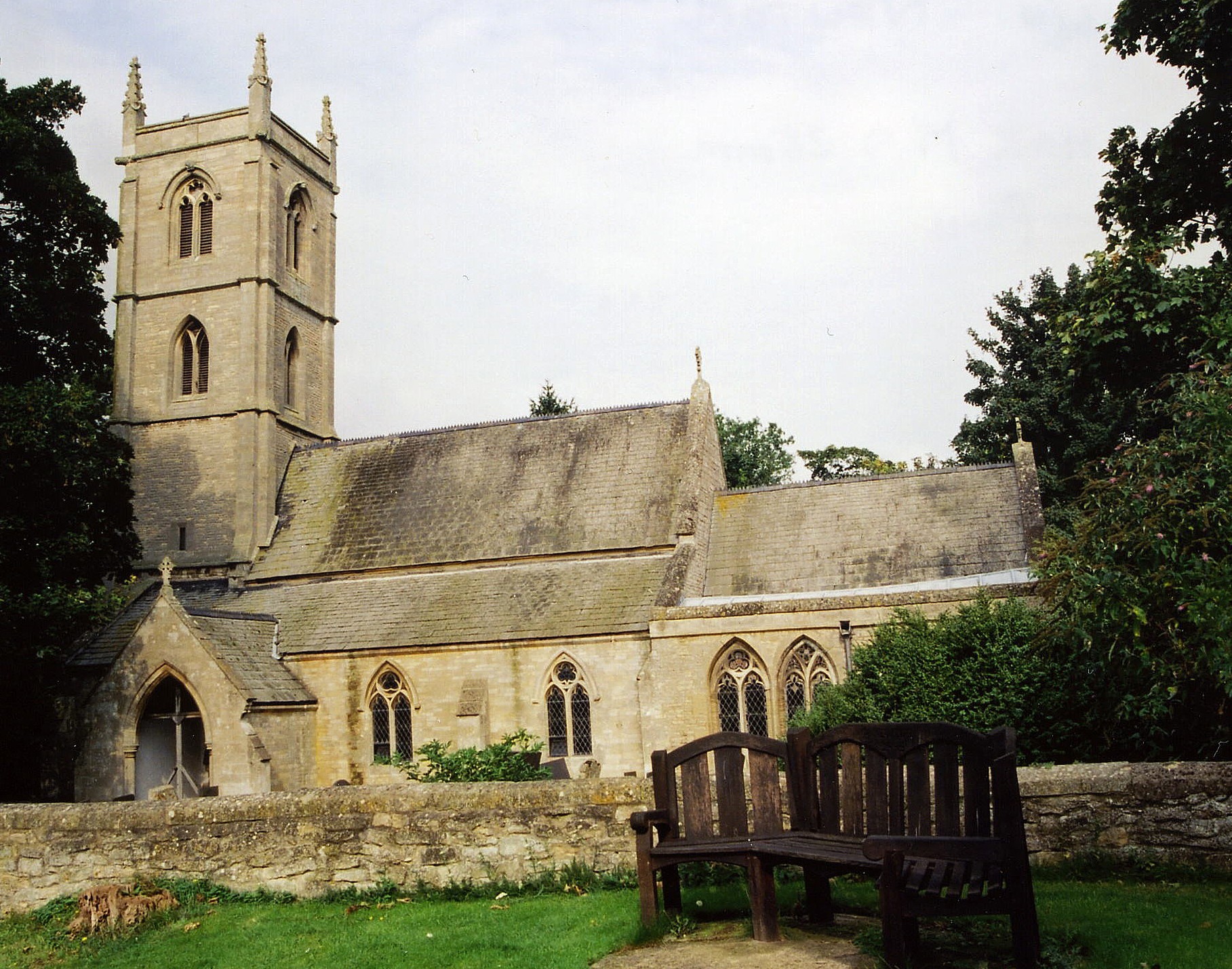
- The Anglican parish church was dedicated to Saint Botolph.
- The church was restored in 1865-66.
- Richard CROFT has a photograph of St. Botolph's Church on Geo-graph, taken in May, 2009.
- Here is a photograph of St. Botolph church, taken by Ron COLE (who retains the copyright):
- The Anglican parish register dates from 1612.
- The Lincolnshire FHS has a Loan Library service which has the parish registers on microfiche for Baptisms from 1584 to 1812 and Marriages from 1611 to 1813.
- The LFHS has published several marriage and burial indexes for the Lafford Deanery to make your search easier.
- Check our Church Records page for county-wide resources.
- The parish was in the Aswarby sub-district of the Bourne Registration District.
- In an 1890 re-organisation, the parish was transferred to the Leadenham sub-district.
- Check our Civil Registration page for sources and background on Civil Registration which began in July, 1837.
Newton (by Folkingham), is both a village and parish south of Sleaford. Threckingham parish lies to the east.
If you are planning a visit:
- The village is just south of the A52 trunk road and just west of the A15's junction with that road.
- Check out our touring page for resources.
- Ask for a calculation of the distance from Newton to another place.
- Newton House was built in 1839-41.
- Newton House was the property of Sir Charles Glynne Earle WELBY in 1911.
- See our Maps page for additional resources.
You can see maps centred on OS grid reference TF048362 (Lat/Lon: 52.913014, -0.442963), Newton which are provided by:
- OpenStreetMap
- Google Maps
- StreetMap (Current Ordnance Survey maps)
- Bing (was Multimap)
- Old Maps Online
- National Library of Scotland (Old Ordnance Survey maps)
- Vision of Britain (Click "Historical units & statistics" for administrative areas.)
- English Jurisdictions in 1851 (Unfortunately the LDS have removed the facility to enable us to specify a starting location, you will need to search yourself on their map.)
- Magic (Geographic information) (Click + on map if it doesn't show)
- GeoHack (Links to on-line maps and location specific services.)
- All places within the same township/parish shown on an Openstreetmap map.
- Nearby townships/parishes shown on an Openstreetmap map.
- Nearby places shown on an Openstreetmap map.
- The parish was in the ancient Aveland Wapentake in the North Kesteven district in the parts of Kesteven.
- For today's district governance, see the North Kesteven District Council.
- Bastardy cases would be heard in the Sleaford petty session hearings every Monday.
- The poor of Walcot parish had 10 shillings from land rented at Newton. The donor of this parcel was unknown.
- As a result of the 1834 Poor Law Amendment Act, the parish became part of the Sleaford Poor Law Union.
- A Public Elementary Schools was built here in 1874 to hold up to 103 children.
- For more on researching school records, see our Schools Research page.