
Hide
West Halton
hide
Hide
hide
Hide
hide
Hide
Hide
Hide
- West Halton was part of the Winterton sub-district of the Glanford Brigg Registration District.
- The North Lincolnshire Library has the census returns from 1841 through 1901.
- Check our Census Resource page for county-wide resources.
- The table below gives census piece numbers, where known:
| Census Year | Piece No. |
|---|---|
| 1841 | H.O. 107 / 636 |
| 1861 | R.G. 9 / 2400 |
| 1871 | R.G. 10 / 3432 & 3433 |
| 1891 | R.G. 12 / 2627 |
- Christianity came early to West Halton. Saint Paulinus converted some of the local Anglo-Saxons to Christianity and built a religious house here by the beginning of the eighth century.
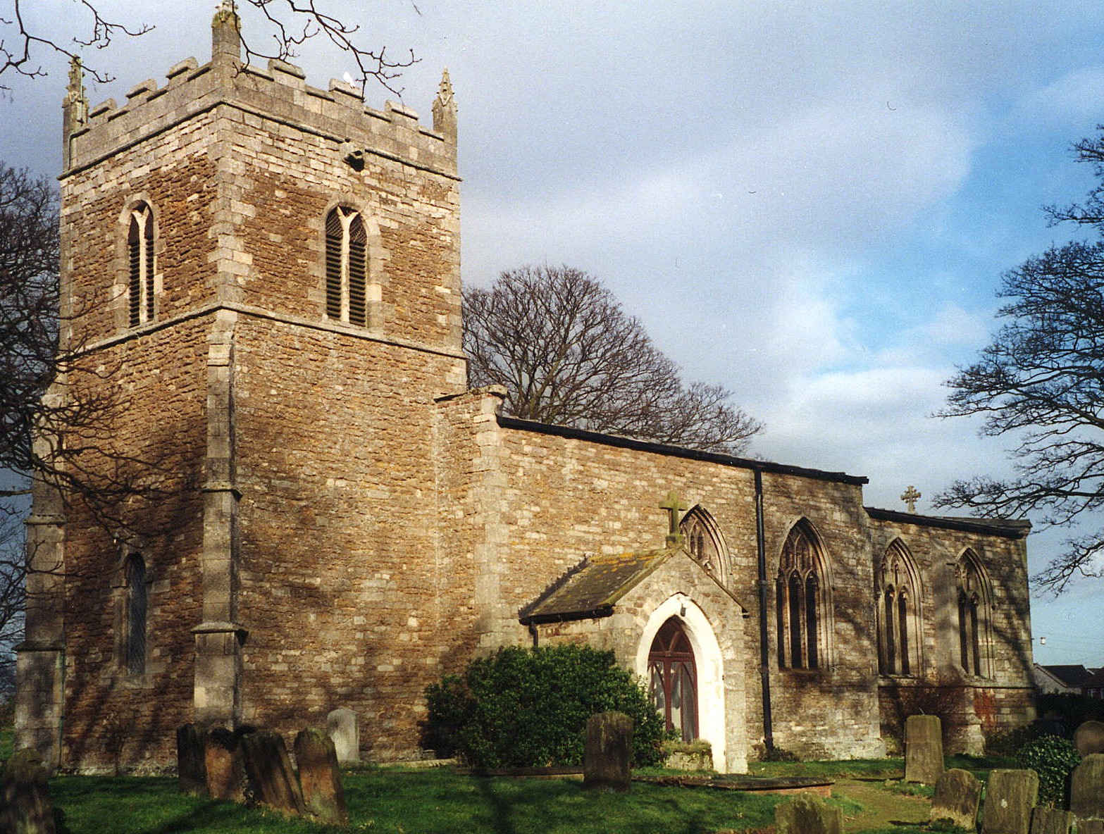
- The Anglican church, erected in 1695, is dedicated to Saint Etheldreda.
- An earlier church structure burned to the ground in 1682.
- The church chancel was rebuilt in 1876-77.
- The church seats 250 people.
- There is a photograph of St. Etheldreda Church on the Wendy PARKINSON Church Photos web site.
- Here is a photo of St. Etheldreda's Church, taken by Ron COLE (who retains the copyright):
- The Anglican parish registers exist from 1538.
- Check the Manlake Deanery to see what LFHS indexes exist.
- The Primitive Methodists built a chapel here in 1877. Currently the Antiochian Orthodox have a chapel at West Halton.For information and assistance in researching these chapels, see our non-conformist religions page.
- Check our Church Records page for county-wide resources.
- The parish was part of the Winterton sub-district of the Glanford Brigg Registration District.
- Check our Civil Registration page for sources and background on Civil Registration which began in July, 1837.
West Halton is a parish and a village in the north of Lincolnshire, just two miles south of the River Humber and east of the River Trent. It lies between the parishes of Whitton and Burton on Strather, and is bounded on the west by Alkborough and on the east by Winteringham parish. The parish covers about 2,000 acres and includes the hamlet of Coleby, which lies about a mile south of the village of West Halton. For many years, until 1861, the parish was much larger and included a portion of Gunness parish (as a chapelry). For more information about the parish, see the North Lincolnshire Council web site.
If you are planning a visit:
- The village itself is best reached by taking the A1077 Trunk Road north out of Scunthorpe toward Winteringham, but turning left after passing Winterton. The village lies in a vale between two Chalk Hills ridges.
- Visit our touring page for visitor services.
- Ask for a calculation of the distance from West Halton to another place.
- See our Maps page for additional resources.
You can see maps centred on OS grid reference SE906210 (Lat/Lon: 53.6779, -0.629997), West Halton which are provided by:
- OpenStreetMap
- Google Maps
- StreetMap (Current Ordnance Survey maps)
- Bing (was Multimap)
- Old Maps Online
- National Library of Scotland (Old Ordnance Survey maps)
- Vision of Britain (Click "Historical units & statistics" for administrative areas.)
- English Jurisdictions in 1851 (Unfortunately the LDS have removed the facility to enable us to specify a starting location, you will need to search yourself on their map.)
- Magic (Geographic information) (Click + on map if it doesn't show)
- GeoHack (Links to on-line maps and location specific services.)
- All places within the same township/parish shown on an Openstreetmap map.
- Nearby townships/parishes shown on an Openstreetmap map.
- Nearby places shown on an Openstreetmap map.
- In the churchyard at St. Ethelreda's Church there is a monument to one man from World War I and a second monument to another from World War II.
- The name Halton is common in England and comes from Old English halh+tun meaning "farmstead in a nook or corner". In the Domesday Book of 1086, the name appears as Haltone. Coleby is Old Scandinavian Koli+by meaning "farmstead of a man called Koli".
[A. D. Mills, "A Dictionary of English Place-Names," Oxford University Press, 1991]
- This place was an ancient parish in Lincoln county and became a modern Civil Parish when those were established.
- The parish was in the ancient Manley Wapentake in the Glanford district in the parts of Lindsey.
- District governance is currently provided by the North Lincolnshire Council.
- Bastardy cases would be heard at the Winterton petty session hearings.
- Care for the poor of the parish extends back prior to the 1772 Enclosure Laws with a grant by the Rev. Thomas Patteson in 1766.
- After the Poor Law Amendment Act reforms of 1834, this parish became part of the Glanford Brigg Poor Law Union.
- A parish school was built here in 1856 and by 1871 was schooling about 20 children.
- For more on researching school records, see our Schools Research page.