
Hide
St Margaret Moses
hide
Hide
hide
Hide
Hide
Hide
"ST. MARGARET MOSES, the church of, stood formerly at the south-west corner of Little Friday-street, opposite Distaff-lane, and was named after the before-mentioned saint, and one Moses its rebuilder; but having been destroyed by the fire of London, the parish was united to that of St Mildred, Bread-street, and the church was not rebuilt." [James Elmes. A Topographical Dictionary of London and its Environs (1831) - transcribed by Brian Randell]
Hide
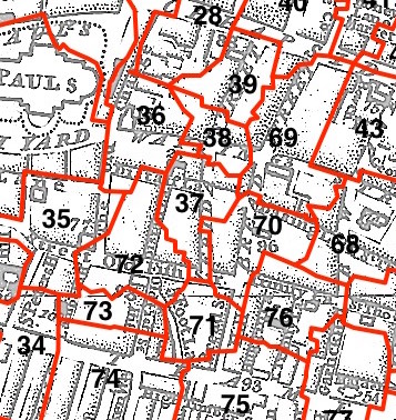
This parish - no. 37 in the above map - is located in Bread Street Ward.
The church was destroyed in 1666 and not rebuilt.
The parish was later united with St Mildred Bread Street 1670, St Mary le Bow 1954.
Hide
London Metropolitan Archive holdings for St Margaret Moses.
Online Parish Register Images and Indexes for St Margaret Moses parish are provided by, or at various subscription sites via, the LDS FamilySearch wiki.
No non-Church of England denominations have been identified for St Mildred Bread Street with St Margaret Moses [LDS FamilySearch Wiki].
Bannerman, William Bruce. The registers of St. Mildred, Bread Street, and of St. Margaret Moses, Friday Street, London. [Mitchell, Hughes and Clarke, printers] (1912) 125 pp. [Full text]
Wikipedia page on St Margaret Moses.
- Ask for a calculation of the distance from St Margaret Moses to another place.
Summary history of St Margaret Moses parish, from the Worshipful Company of Parish Clerks.
Public Houses, Inns & Taverns of the parish of St Margaret Moses - provides "information from census records, trade directories, etc."
You can see maps centred on OS grid reference TQ322810 (Lat/Lon: 51.512714, -0.095953), St Margaret Moses which are provided by:
- OpenStreetMap
- Google Maps
- StreetMap (Current Ordnance Survey maps)
- Bing (was Multimap)
- Old Maps Online
- National Library of Scotland (Old Ordnance Survey maps)
- Vision of Britain (Click "Historical units & statistics" for administrative areas.)
- English Jurisdictions in 1851 (Unfortunately the LDS have removed the facility to enable us to specify a starting location, you will need to search yourself on their map.)
- Magic (Geographic information) (Click + on map if it doesn't show)
- GeoHack (Links to on-line maps and location specific services.)
- All places within the same township/parish shown on an Openstreetmap map.
- Nearby townships/parishes shown on an Openstreetmap map.
- Nearby places shown on an Openstreetmap map.
Surnames from the 1881 census in the St Margaret Moses district.
Clerical career summaries for the parish of (i) St Margaret Moses and (ii) St Mildred Bread Street With St Margaret Moses, from the Clergy of the Church of England Database website.
Sources for listings of taxpayer names for St Margaret Moses parish, listed on the LDS FamilySearch wiki.