
Hide
St Matthew Friday-street
hide
Hide
hide
Hide
Hide
Hide
"ST. MATTHEW, Friday-street, the church of, is situated on the west side of that street, a short distance from Cheapside. The patronage of this church was anciently in the Abbot and Convent of Westminster, and upon their suppression, when the conventual church was converted into a cathedral, Henry VIII. conferred it on the Bishop of Westminster. . . The old church was destroyed by the great fire of 1666, and the present plain solid and useful structure erected in its stead, by Sir Christopher Wren, in 1685. At the union of the small parishes of the city with the larger, that of St Peter Cheap, which stood at the corner of Wood-street, Cheapside, was united to this. . . The united parishes form one rectory, in the city, diocese and archdeaconry of London, and in the alternate patronage of the Bishop of London and the duke of Buccleugh. The present rector is the Rev. George Avery Hatch, who was instituted by the Bishop of London in 1791. The next presentation is therefore in the Duke." [James Elmes. A Topographical Dictionary of London and its Environs (1831) - transcribed by Brian Randell]
Hide
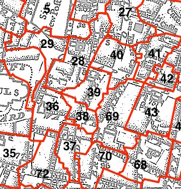
This parish - no. 39 in the above map - is located in Farringdon Within Ward.
The church was destroyed in 1666, rebuilt by Wren, sold 1881, demolished 1885.
The parish was later united with St Vedast Foster Lane 1882.
Hide
London Metropolitan Archive holdings for St Matthew Friday-street.
Object of the month: 17th century Reredos (archived version) - acquired for Polesden Lacy House, Surrey, after St Matthew Friday-Street was demolished in 1883.
Online Parish Register Images and Indexes for St Matthew Friday-street parish are provided by, or at various subscription sites via, the LDS FamilySearch wiki.
No non-Church of England denominations have been identified for St Matthew Friday Street with St Peter Cheap [LDS FamilySearch Wiki].
Wikipedia page on St Matthew Friday-street.
- Ask for a calculation of the distance from St Matthew Friday-street to another place.
Summary history of St Matthew Friday-street parish, from the Worshipful Company of Parish Clerks.
You can see maps centred on OS grid reference TQ323812 (Lat/Lon: 51.513928, -0.095508), St Matthew Friday-street which are provided by:
- OpenStreetMap
- Google Maps
- StreetMap (Current Ordnance Survey maps)
- Bing (was Multimap)
- Old Maps Online
- National Library of Scotland (Old Ordnance Survey maps)
- Vision of Britain (Click "Historical units & statistics" for administrative areas.)
- English Jurisdictions in 1851 (Unfortunately the LDS have removed the facility to enable us to specify a starting location, you will need to search yourself on their map.)
- Magic (Geographic information) (Click + on map if it doesn't show)
- GeoHack (Links to on-line maps and location specific services.)
- All places within the same township/parish shown on an Openstreetmap map.
- Nearby townships/parishes shown on an Openstreetmap map.
- Nearby places shown on an Openstreetmap map.
Surnames from the 1881 census in the St Matthew Friday and St Matthew Friday Street districts.
Clerical career summaries for the parish of (i) St Matthew Friday-street and (ii) St Matthew Friday Street With St Peter Cheap, from the Clergy of the Church of England Database website.
Sources for listings of taxpayer names for St Matthew Friday-street parish, listed on the LDS FamilySearch wiki.