
Hide
Carham
hide
Hide
hide
Hide
Hide
Hide
"CARHAM PARISH is situated at the north-west corner of Northumberland, being bounded on the north and west by Scotland, on the south by the Beaumont rivulet, and on the east by the parishes of Branxton and Ford. Though it is about 6 miles in length from east to west, and 4 miles in breadth from north to south, it is not properly divided into townships, but contains the following hamlets, viz.- Carham, Downham, Hagg, East and West Learmouth, Mindrum, Moneylaws, Presson, Shidlaw, Tithehill, Wark and Wark Common, which together contained, in 1801, a population of 1192 persons, who, in 1811, had increased to 1316, and in 1821, to 1370, consister on 242 families, resident in 240 houses....." [From History, Directory, and Gazetteer of the counties of Durham and Northumberland, Parson and White, 1828]
Hide
- Northumberland County Record Office holds copies of Census Returns 1841 - 1891 and provides a useful User Guide .
- The 1851 Census Index (microfiche CN34)
- 1891Census Northumberland – Ford (Carham, Wark, Downham, Presson, Branxton, Ford, Etal and New Etal, Crookham, Kimmerston, Berryhill, Lowick, Bowsden, Barmoor, Holburn, Millfield, Crookhouse, Lanton, Coupland, Coupland, Howtell, Kilham, Paston, Coldsmouth and Thompsons Wall, Kirknewton, Westnewton, Yeavering, Hethpool and Greys Forest) (PRO piece RG12/4270) (Type B) (Book) (Volume 80) BOTH published by the https://www.ndfhs.org.uk/ may be of value to researchers interested in this parish.
- Carham - Church Records - links and information.
- This area is within Northumberland North First Registration District.
- Certificates of birth, death and marriage can be ordered from Northumberland County Council.
- The Northumberland Communities website includes pages relating to Wark-on-Tweed. They provide "a range of learning resource material that reflects Northumberland's heritage, providing a base for studying the County's history. The website provides a starting point for understanding the development of communities in Northumberland. It also seeks to illustrate the range of sources for family and local history research that are available via Northumberland Archives Service."
- The section of The National Gazetteer (1868) relating to this parish - transcribed by Colin Hinson.
- Ask for a calculation of the distance from Carham to another place.
- The history of Carham Parish is included in:- Northumberland County History Committee, History of Northumberland, Volume 11. Newcastle, A. Reid, 1922.
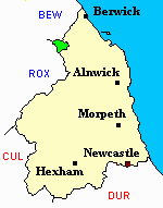
- Carham - Maps - links and information.
You can see maps centred on OS grid reference NT847352 (Lat/Lon: 55.610431, -2.243698), Carham which are provided by:
- OpenStreetMap
- Google Maps
- StreetMap (Current Ordnance Survey maps)
- Bing (was Multimap)
- Old Maps Online
- National Library of Scotland (Old Ordnance Survey maps)
- Vision of Britain (Click "Historical units & statistics" for administrative areas.)
- English Jurisdictions in 1851 (Unfortunately the LDS have removed the facility to enable us to specify a starting location, you will need to search yourself on their map.)
- Magic (Geographic information) (Click + on map if it doesn't show)
- GeoHack (Links to on-line maps and location specific services.)
- All places within the same township/parish shown on an Openstreetmap map.
- Nearby townships/parishes shown on an Openstreetmap map.
- Nearby places shown on an Openstreetmap map.