
Hide
Gosforth
hide
Hide
hide
Hide
Hide
Hide
"GOSFORTH parish comprises the townships of East Brunton, West Brunton, Coxlodge, Fawdon, North Gosforth, South Gosforth, and East and West Kenton. It is bounded on the north-west by Dinnington parish, on the west by Newburn parish, on the south by the parishes of All Saints, St Andrew, and St. John, and on the east and north-east by Long Benton parish. It is about two miles from north to south, about three miles from east to west, and comprises an area of 6,355 statute acres. The number of inhabitants in 1801, was 1,385; in 1811, 1,988; in 1821, 3,295; in 1831, 3,546; in 1841, 3,020; and in 1851, 2,319 souls. There are several excellent coal mines in this parish, in which great numbers of the inhabitants are employed." [From History, Topography, and Directory of Northumberland, Whellan, 1855]
Hide
- History of the parish of Gosforth Richard Welford 1897
- Gosforth remembered Andrew Clark & George Nairn 2017
- A History of the County of Northumberland by John C Hodgeson 1840 vol 13 includes Gosforth
- Tyne & Wear Archives have records for Gosforth Cemetery.
- Grave registers 1908-1923 for Hazelrigg Cemetery (Jewish) can be seen at Tyne & Wear Archives
- Northumberland County Record Office holds copies of Census Returns 1841 - 1891 and provides a useful User Guide
- The 1851 Census Index (microfiche CN14)
- 1891 Census Ponteland 1A (Ponteland, High and Little Callerton, Darras Hall, Coldcoats, Milbourne, Belsay, Whalton, Ogle, Twizell, Shilvington, part of Stannington, North and South Gosforth and Coxlodge) (PRO piece RG12/4240) (Type B) (Book) (Volume 50)
- 1891 Census Ponteland 1B (Coxlodge, Fawdon, East and West Brunton, Kenton, Dinnington, Mason, Brenkley, Prestwick, Woolsington, Horton Grange, Kirley and Berwick Hill) (PRO piece RG12/4241) (Type B) (Book) (Volume 51) ALL published by the https://www.ndfhs.org.uk/ may be of value to researchers interested in this parish.
- The parish is thought to date from Saxon times, but nothing is known of the first church. The church demolished here in 1799, may itself have been a replacement for the original church. The present church of St Nicholas, on Church Road, was built in 1799 and enlarged in 1820, 1833, 1884, 1913 and 1959. The churchyard still contains many headstones.
- Gosforth, All Saints, on West Avenue was built in 1887 to serve a large area in the north and west of St Nicholas Parish. Modern parishes of The Ascension at Kenton, and The Epiphany, now serve parts of this area.
- The Ancestral Indexes website provides information about Gosforth All Saints.
- Gosforth - Church Records - links and information.
- This area is within Newcastle upon Tyne Registration District
- Certificates of birth, death and marriage can be ordered by post.
Information. Searches.
- The section of The National Gazetteer (1868) relating to this parish - transcribed by Colin Hinson.
- Ask for a calculation of the distance from Gosforth to another place.
- The history of Gosforth Parish is included in:- Northumberland County History Committee, History of Northumberland, Volume 13. Newcastle, A. Reid, 1930. (Available on fiche from Ancestral Indexes).
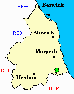
- Gosforth - Maps - links and information.
You can see maps centred on OS grid reference NZ230688 (Lat/Lon: 55.013249, -1.642414), Gosforth which are provided by:
- OpenStreetMap
- Google Maps
- StreetMap (Current Ordnance Survey maps)
- Bing (was Multimap)
- Old Maps Online
- National Library of Scotland (Old Ordnance Survey maps)
- Vision of Britain (Click "Historical units & statistics" for administrative areas.)
- English Jurisdictions in 1851 (Unfortunately the LDS have removed the facility to enable us to specify a starting location, you will need to search yourself on their map.)
- Magic (Geographic information) (Click + on map if it doesn't show)
- GeoHack (Links to on-line maps and location specific services.)
- All places within the same township/parish shown on an Openstreetmap map.
- Nearby townships/parishes shown on an Openstreetmap map.
- Nearby places shown on an Openstreetmap map.
- Gosforth Parish was part of Castle Ward Poor Law Union. The Union Workhouse was located near the village of Ponteland. Some records relating to the workhouse have survived and are held at Northumberland Record Office, though they are of limited use for family history.
- Asburton House, Elmfield Road, Gosforth, a Roman Catholic Industrial School for Girls opened in 1884, and was run by the Sisters of Charity in 1895, it could accommodate 100 girls up to the age of 12. The school was closed in 1905 and girls still at the school were transferred to Darlington. The hose was demolished in 1907. No records have been traced for this establishment
- The Chadwick Memorial Industrial School for Roman Catholic Boys opened in 1882 in a building formerly used as the grandstand to the old racecourse on Grandstand Road Newcastle, it could accommodate 200 boys between the age of 7 and 16 for had been 'detained' by magistrates. The boys were removed to new premises in Stanwix near Carlisle in 1905. The building on Grandstand Road was later used as an ice rink and later as a factory for building aircraft and airships by Armstron Whitworths. No records have been traced for this establishment.