Hide
Loftus
hide
Hide
hide
Hide
Hide
hide
Hide
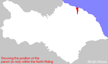
The Ancient Parish of LOFTUS
[Transcribed information mainly from the early 1820s]
"LOFTUS, (earlier was Lofthouse - beware the Lofthouse in WRY though!) a parish in the wapentake and liberty of Langbargh; 9 miles ENE. of Guisborough; bounded on the north by the German ocean. It is a pleasant village, forming one continued street, or line of buildings, principally of stone; the neighbourhood abounding with stone and alum rock. The village is chiefly dependent upon the alum works here, belonging to Lord Dundas. There is a market held here on Thursday, by custom; and there is a Methodist chapel, built by subscription in 1820. The church is dedicated to St. Leonard (see Churches for photograph), and the living is a rectory, in the patronage of the King. Pop. including Waupley, 1178." (There is further information for Loftus)."HANDALE, in the parish of Loftus, wapentake and liberty of Langbargh; 1¾ miles SSE. of Loftus, 8 miles ENE. of Guisborough. There is here a shooting box of Edmund Turton, Esq.
A Benedictine Priory was founded here in 1133, dedicated to the Virgin Mary, by William de Percy, grandson of the first William de Percy, who endowed it with lands in Grendale, Dunsley, and Staxton. At the dissolution there were eight Nuns, when the revenue was only 13L. 19s. --Dugdale, 20L. 7s. 8d. --Speed. The site of this Priory was granted, 35 Henry VIII. to Ambrose Beckwith, in those, descendants it continued for several generations. It is now the property of Thos. Stevenson, Esq. -Tanner. -Burton. Little of this monastic building now remains, except the west-end of the chapel, and some of the walls which are observable in the farm-house erected on the site. --Graves."
"HUMMERSEA, a single house in the township and parish of Loftus; ¾ mile NNE. of Loftus."
"STREET HOUSES, 3 farm houses in the parish of Loftus, and wapentake of Langbargh; 1½ miles ENE. of Loftus, 1 mile NE. of Loftus; the residence of Mr. J. C. Liomin."
"WAUPLEY, (or Wapley, later High Waupley), in the parish of Loftus, wapentake & liberty of Langbargh; 2½ miles SSE. of Loftus."
"WAUPLEY NEW INN, in the township and parish of Loftus; 3¾ miles SSE. of Loftus."
[Description(s) edited mainly from various 19th century sources by Colin Hinson. ©2010]
Hide
- Here is are photographs of Cemeteries in the parish:
- The Cemetery Chapel, Loftus. (Was used only for burials).
- Here are photographs of Churches in the parish:
- St. Leonard's Church, Loftus.
- St. Joseph and St Cuthbert's Roman Catholic Church, Loftus.
- The United Reformed Church, Loftus.
- The former Primitive Methodist Church, Loftus.
- Deepdale Pentecostal Assemblies of God Church, Loftus. (Formerly a Methodist Chapel.)
- St. Hilda's Church, Liverton Mines.
- The former Wesleyan Methodist Church, Liverton Mines, now a commercial premises.
- Transcript of the entry for Loftus in the "Collections relative to Churches and Chapels".
- The whereabouts and dates of the Registers etc. for the Parish of Loftus.
- Transcript of the entry of "professions and trades" in the Baines's Directory of 1823, of the North Riding.
- Transcript of the entry of "professions and trades" in the White's Directory of 1840, Yorkshire section.
- Transcript of the entry of "professions and trades" in the Bulmers Directory of 1890. of the North Riding.
- There is further information about this parish from the National Gazetteer 1868, Yorkshire extracts.
- There is further information about this parish from the Lewis's Topographical Dictionary of England 1835, Yorkshire extracts.
- There is further information about this parish from the Bulmer's 1890 History and Directory of the North Riding.
- Ask for a calculation of the distance from Loftus to another place.

- For a detailed map of this parish see this parish boundaries map.
- For a more detailed map of the parishes in the riding please see the Yorkshire parish maps page.
- For a more detailed map of the county please see the Yorkshire map page.
- Here is a map showing the wapentakes for the county.
You can see maps centred on OS grid reference NZ718184 (Lat/Lon: 54.555758, -0.891329), Loftus which are provided by:
- OpenStreetMap
- Google Maps
- StreetMap (Current Ordnance Survey maps)
- Bing (was Multimap)
- Old Maps Online
- National Library of Scotland (Old Ordnance Survey maps)
- Vision of Britain (Click "Historical units & statistics" for administrative areas.)
- English Jurisdictions in 1851 (Unfortunately the LDS have removed the facility to enable us to specify a starting location, you will need to search yourself on their map.)
- Magic (Geographic information) (Click + on map if it doesn't show)
- GeoHack (Links to on-line maps and location specific services.)
- All places within the same township/parish shown on an Openstreetmap map.
- Nearby townships/parishes shown on an Openstreetmap map.
- Nearby places shown on an Openstreetmap map.
- This parish is covered by the following Society:

