Hide
Kippax
hide
Hide
hide
Hide
Hide
The Ancient Parish of KIPPAX
[Transcribed information mainly from the early 1820s]
"KIPPAX, a parish-town, in the lower-division of Skyrack, liberty of Pontefract; 5½ miles from Pontefract, 8 E. of Leeds, 9 from Wakefield, 21 from York. Pop. 958. The Church is a vicarage, dedicated to St. Mary (see Churches for photograph), in the deanry of the Ainsty, value, ~£5. 7s. 1d. Patron, the King.""ALLERTON BYWATER, in the parish of Kippax, Lower-division of Skyrack, liberty of Pontefract; 5 miles NW. of Pontefract, 9 from Leeds and Wakefield. Pop. 329."
"GREAT PRESTON, in the parish of Kippax, lower-division of Skyrack, liberty of Pontefract; 7 miles NW. of Pontefract, 5 from Wakefield and Leeds. Pop. 478."
"KIPPAX PARK, the seat of Thomas Davison Bland, Esq. in the township and parish of Kippax, lower-division of Skyrack, liberty of Pontefract;
This Park is large and beautiful, rising to the Mansion, which was originally founded by Sir Thomas Bland, Knight, in the reign of Elizabeth. A part only of the ancient front remains in the centre of the building. The fabric was much enlarged about the latter end of the 17th century; and the principal front, including the offices, now extends 600 feet in length.
The family of Bland was anciently seated at Bland's Gill, in Yorkshire; a younger son of which house was Robert Bland, Esq. of Leeming, N.R. whose posterity continued the principal line; the male issue of the chief house of Bland's Gill, soon failing: the title of Baronet, became extinct, on the death of Sir Hungerford Bland, who died a bachelor, some time previous to 1779. The present family is descended from Thomas Davison, of Blackiston, Esq. in the county of Durham, he having married a daughter of Sir John Bland, Bart. --Neale's Views."
"LITTLE PRESTON, in the township of Great Preston, and parish of Kippax, lower-division of Skyrack, liberty of Pontefract; 7 miles from Leeds, 5 NW. of Pontefract and 5 from Wakefield."
"ROACH GRANGE, a single house in the township and parish of Kippax; 4 miles S. of Aberford."
[Description(s) edited from various 19th century sources by Colin Hinson © 2013]
Hide
- There is a list of cemeteries (as opposed to Church Graveyards) for this area on the Leeds City Council's website.
- If you are looking for Kippax in the 1891 census, you may be interested in the following quote from the West Riding mailing list:
- To all of you who responded to my enquiry regarding the lost village of KIPPAX on the 1891 Yorkshire census. my grateful thanks. To any of you who may be also looking for the place, it is listed under the miss-spelt name of LIPPAX. Thanks for all your help.
Kind regards,
Liz from Lincs
- To all of you who responded to my enquiry regarding the lost village of KIPPAX on the 1891 Yorkshire census. my grateful thanks. To any of you who may be also looking for the place, it is listed under the miss-spelt name of LIPPAX. Thanks for all your help.
- Here are photographs of and in the Parish Church and other churches in the parish:
- St. Mary the Virgin's Church, Kippax. This church was mentioned in the Doomsday book and is on a site used long (The Church's website is here.) before that for worship. It belonged to the Clunic priory of St John at Pontefract in 1090.
- The Altar, St. Mary's Church.
- The Roll of War Dead, Kippax, 1914 - 1919.
- The Church of St. Mary the Less, Allerton Bywater.
- The Methodist Church, Allerton Bywater.
- The Roman Catholic Church, Allerton Bywater.
- The Inter-denominational Mission Hall, Allerton Bywater.
- Transcript of the entry for Kippax in the "Collections relative to Churches and Chapels".
- The whereabouts and dates of the Registers etc. for the Parish of Kippax.
- Transcript of the entry of "professions and trades" in the Baines's Directory and Gazetteer, Vol I, West Riding.
- There is further information about this parish from the National Gazetteer 1868, Yorkshire extracts.
- There is further information about this parish from the Lewis's Topographical Dictionary of England, Yorkshire extracts.
- There is further information about this parish from the Stephen Whatley's Gazetteer 1750, Yorkshire extracts.
- Ask for a calculation of the distance from Kippax to another place.

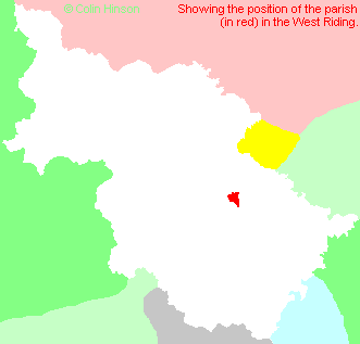
- For a detailed map of this parish see this parish boundaries map.
- For a more detailed map of the parishes in the riding please see the Yorkshire parish maps page.
- For a more detailed map of the county please see the Yorkshire map page.
- Here is a map showing the wapentakes for the county.
You can see maps centred on OS grid reference SE415305 (Lat/Lon: 53.769198, -1.371864), Kippax which are provided by:
- OpenStreetMap
- Google Maps
- StreetMap (Current Ordnance Survey maps)
- Bing (was Multimap)
- Old Maps Online
- National Library of Scotland (Old Ordnance Survey maps)
- Vision of Britain (Click "Historical units & statistics" for administrative areas.)
- English Jurisdictions in 1851 (Unfortunately the LDS have removed the facility to enable us to specify a starting location, you will need to search yourself on their map.)
- Magic (Geographic information) (Click + on map if it doesn't show)
- GeoHack (Links to on-line maps and location specific services.)
- All places within the same township/parish shown on an Openstreetmap map.
- Nearby townships/parishes shown on an Openstreetmap map.
- Nearby places shown on an Openstreetmap map.
- The World War I and World War II memorial at Allerton Bywater.
- This parish is covered (or partly covered) by the following Societies:
- A list of those paying the 1379 Subsidy Rolls (Poll Tax) for this parish.

