
Hide
Church Road, Holywood, Methodist
hide
Hide
Hide
Methodist church,
Church Road/Church View,
Holywood
County Down
Hide
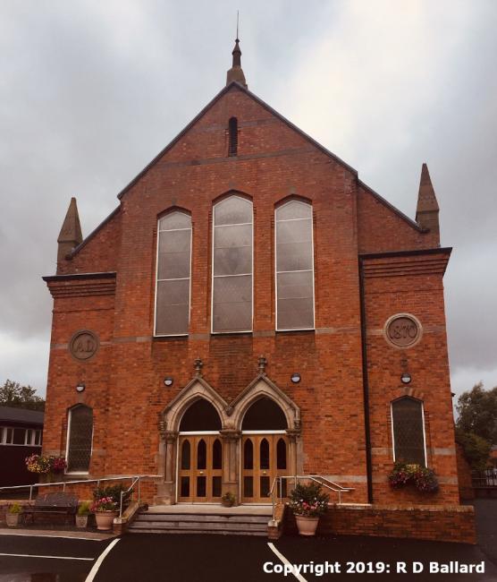
The congregation was founded prior to 1838, using temporary premises until (in 1838) a church building was opened on the High Street. This was replaced by the present building on Church Street in 1870.
It is located at NW5277234070 (Lat/Lon 54.64098, -5.833054). You can see this on maps provided by:
- OpenStreetMap
- Google Maps
- Bing (was Multimap)
- Vision of Britain (Click "Historical units & statistics" for administrative areas.)
- Copy
Church Road, Holywood, Methodistand paste it along with the county name into the search box at Ordnance Survey Ireland. - GeoHack (Links to on-line maps and location specific services.)