
Hide
Rathven, Church of Scotland
hide
Hide
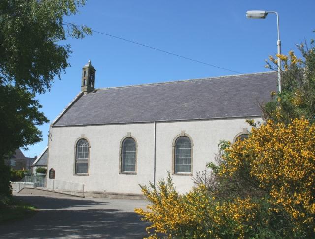
Rathven, Banffshire
© Copyright Anne Burgess and licensed for reuse under this Creative Commons Licence.
Hide
Church of Scotland,
Rathven
Hide
The plain and simple Rathven Parish Kirk stands at the east end of the village of Rathven. It dates from 1794, replacing an earlier kirk, the remains of which are in the kirkyard a hundred metres or so to the west.
It is located at NJ4446165696 (Lat/Lon 57.677677, -2.932901). You can see this on maps provided by:
- OpenStreetMap
- Google Maps
- StreetMap (Current Ordnance Survey maps)
- Bing (was Multimap)
- Old Maps Online
- National Library of Scotland (Old Ordnance Survey maps)
- Vision of Britain (Click "Historical units & statistics" for administrative areas.)
- Magic (Geographic information) (Click + on map if it doesn't show)
- GeoHack (Links to on-line maps and location specific services.)