
Hide
Suddy, Church of Scotland
hide
Hide
© Copyright Julian Paren and licensed for reuse under this Creative Commons Licence.
Hide
Church of Scotland,
Suddy (Suddie)
Hide
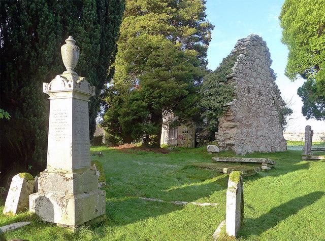
St Duthac's Church (remains of)
The parishes of Kilmuir Wester and Suddie were united to form Knockbain Parish with the combined parish church being built in 1754. Both the churches at Kilmuir and Suddie were neglected and are now ruins. The only surviving part of the Suddie Church is the East wall and part of a northern wall. The image shows the East Wall of the church and some of the burial ground.
It is located at NH6656554752 (Lat/Lon 57.563085, -4.232169). You can see this on maps provided by:
- OpenStreetMap
- Google Maps
- StreetMap (Current Ordnance Survey maps)
- Bing (was Multimap)
- Old Maps Online
- National Library of Scotland (Old Ordnance Survey maps)
- Vision of Britain (Click "Historical units & statistics" for administrative areas.)
- Magic (Geographic information) (Click + on map if it doesn't show)
- GeoHack (Links to on-line maps and location specific services.)