
Hide
Parish Maps from 'Historic Parishes of England and Wales - Boundaries before 1850'
hide
Hide
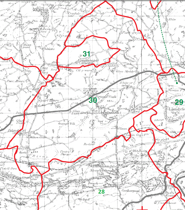
Llangathen Parish Map 30
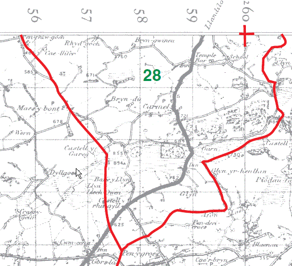
Llanfihangel Aberbythych Parish Map part 28
Llanfihangel Cilfargen Parish Map 31
Llanfihangel Aberbythych Parish Map part 28
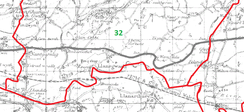
Llanegwad Parish Map part 32
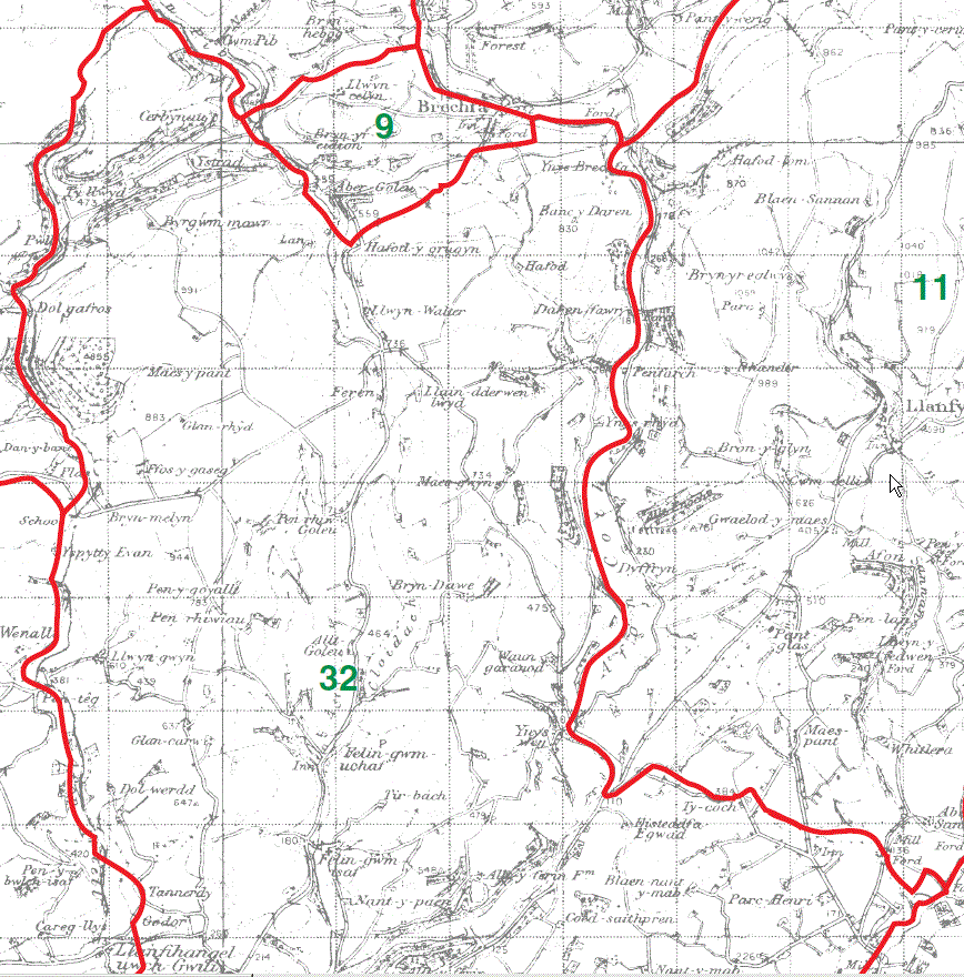
Llanegwad Parish Map part 32
This map is extracted from:
Kain, R.J.P., Oliver, R.R., Historic Parishes of England and Wales: an Electronic Map of Boundaries before 1850 with a Gazetteer and Metadata [computer file]. Colchester, Essex: History Data Service, UK Data Archive [distributor], 17 May 2001. SN: 4348.
Acknowledgement is made to R.J.P. Kain, R.R Oliver, the Economic and Social Research Council, the History Data Service and the UK Data Archive.