Hide
Normanton
hide
Hide
hide
Hide
hide
Hide
Hide
[Transcribed from The National Gazetteer of Great Britain and Ireland 1868]
by Colin Hinson ©2020
Hide
- The parish was in the Grantham sub-district of the Grantham Registration District.
- Check our Census Resource page for county-wide resources.
- The table below gives census piece numbers, where known:
| Census Year | Piece No. |
|---|---|
| 1841 | H.O. 107 / 621 |
| 1861 | R.G. 9 / 2353 |
| 1871 | R.G. 10 / 3363 |
| 1891 | R.G. 12 / 2586 |
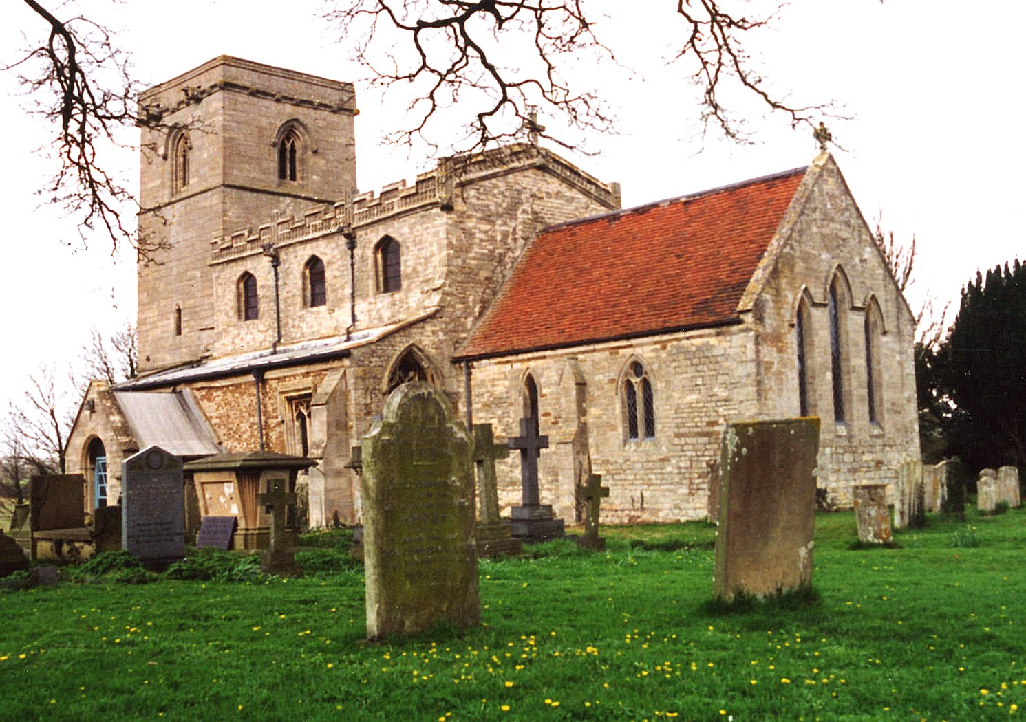
- The present Anglican parish church is dedicated to Saint Nicholas.
- The church seats about 130.
- The Diocese of Lincoln declared this church redundant in February, 1974.
- During much of the year, the church is open for tours on Saturdays and Sundays, 10:00 to 17:00.
- A photograph of St. Nicholas church is at the Wendy PARKINSON English Church Photographs site.
- Here is a photo of St. Nicholas Church, taken by Ron COLE (who retains the copyright):

- The parish register dates from 1670, but Bishop's transcripts go back to 1562.
- The Lincolnshire FHS has a Loan Library service which has the parish registers on microfiche for Baptisms from 1670 to 1812 and Marriages from 1670 to 1812.
- The LFHS has published several marriage indexes for the Loveden Deanery to make your search easier.
- Check our Church Records page for county-wide resources.
- The parish was in the Grantham sub-district of the Grantham Registration District.
- Check our Civil Registration page for sources and background on Civil Registration which began in July, 1837.
This village and parish sits 8 miles north of Grantham and just 2 miles southeast of Caythorpe. The parish covers about 1,550 acres. Ancaster parish is just to the southeast, Carlton Scroop parish to the southwest and Hough on the Hill parish to the west.
The village is right on the A607 trunk road north out of Grantham. If you are planning a visit:
- Take the A17 west out of Sleaford and then the A607 south past Caythorpe.
- Visit our touring page for more sources.
The National Gazetteer of Great Britain and Ireland - 1868
- Ask for a calculation of the distance from Normanton to another place.
- Check the history of the Wapentake at the Loveden Wapentake website.
- In 1871, the Earl BROWNLOW owned nearly all the land in the parish.
- In 1913, the Earl BROWNLOW was the principal landowner.
- See our Maps page for additional resources.
You can see maps centred on OS grid reference SK949465 (Lat/Lon: 53.007554, -0.587425), Normanton which are provided by:
- OpenStreetMap
- Google Maps
- StreetMap (Current Ordnance Survey maps)
- Bing (was Multimap)
- Old Maps Online
- National Library of Scotland (Old Ordnance Survey maps)
- Vision of Britain (Click "Historical units & statistics" for administrative areas.)
- English Jurisdictions in 1851 (Unfortunately the LDS have removed the facility to enable us to specify a starting location, you will need to search yourself on their map.)
- Magic (Geographic information) (Click + on map if it doesn't show)
- GeoHack (Links to on-line maps and location specific services.)
- All places within the same township/parish shown on an Openstreetmap map.
- Nearby townships/parishes shown on an Openstreetmap map.
- Nearby places shown on an Openstreetmap map.
Michael PECK provides us with: "The war memorials at Normanton have now been recorded. There are three, one is dedicated to WW1, one to WW2 and the third is to a named individual. There are no numbers, ranks or arms of service mentioned except for the individual:"
WW1 memorial
- Frank Cartwright
- Walter Crowley
- Joseph S Gale
- Charles Hedworth
- John T Hempsall
- Charles E Spendlow
- Richard Woods
WW2 memorial
- John M Chambers
- John D Andrew
- David Brister
- Edward H Dennison
Individual
- The electric lighting of this church was installed by Thomas Chambers in memory of his son Sub-Lieut John M Chambers killed in action 25th Nov 1940.
- The name Normanton is fairly common. It is Old English northman+tun, or "farmstead of the Northmen or Norwegian Vikings".
[A. D. Mills, "A Dictionary of English Place-Names," Oxford University Press, 1991]
- Here's a list of surnames from White's 1871 Directory: BARNETT, CHAPMAN, CUPIT, FISHER, HUNT, MINTA, POLLARD, RIPLEY, SCOTT, WADESON and WALTON.
- Kelley's 1913 Directory lists these surnames: DUNN, HEDWORTH, HUNT, MINTA, POLLARD, RIPLEY, SHAW, THURLBY and WOOD.
- This place was an ancient parish in Lincolnshire and became a modern Civil Parish when those were established.
- The parish was in the ancient Loveden Wapentake in the South Kesteven district in the parts of Kesteven.
- You may contact the local Carlton Scroop and Normanton Parish Council regarding civic or political issues, but they are NOT staffed to help you with family history searches.
- For today's district governance, contact the South Kesteven District Council.
- Bastardy cases would be heard in the Spittlegate (Grantham) petty session hearings.
- Captain Lewis GWIN's charity provided £3 and 6 shillings yearly for fuel for the poor. An unknown donor contributed another £2.
- After the 1834 Poor Law Amendment Act reforms, the parish became part of the Grantham Poor Law Union in 1837.
- I could find no record of a school prior to 1913.
- For more on researching school records, see our Schools Research page.
