Hide
Hough on the Hill
hide
Hide
hide
Hide
hide
Hide
Hide
"BRANDON, a hamlet in the parish of Hough-on-the-Hill, wapentake of Loveden, parts of Kesteven, in the county of Lincoln, 7 miles to the N. of Grantham. It is not far from the Great Northern railway."
"GELSTON, a hamlet in the parish of Hough-on-the-Hill, wapentake of Loveden, parts of Kesteven, county Lincoln, 6 miles N. of Grantham."
[Transcribed from The National Gazetteer of Great Britain and Ireland 1868]
by Colin Hinson ©2020
Hide
The Library at Grantham will prove useful in your research.
Michael GARLICK has a photograph of the Churchyard on Geo-graph, taken in September, 2016.
- The parish was in the Grantham sub-district of the Grantham Registration District.
- Check our Census Resource page for county-wide resources.
- The table below gives census piece numbers, where known:
| Census Year | Piece No. |
|---|---|
| 1841 | H.O. 107 / 619 |
| 1861 | R.G. 9 / 2353 |
| 1871 | R.G. 10 / 3363 |
| 1881 | R.G. 11 / 3234 |
| 1891 | R.G. 12 / 2586 |
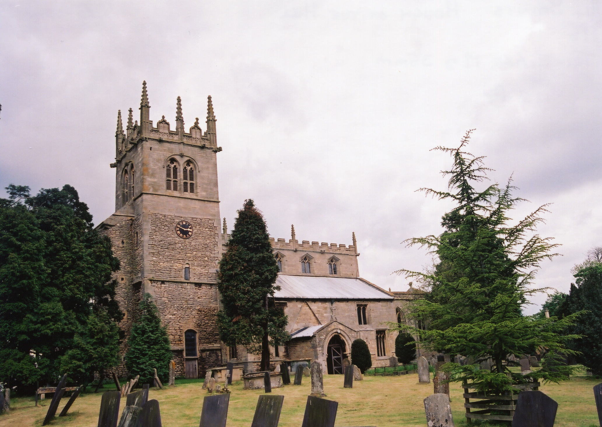
- The existing Anglican parish church is dedicated to All Saints.
- Some parts of the Church of All Saints, particularly the base of the tower, have been dated to Saxon times.
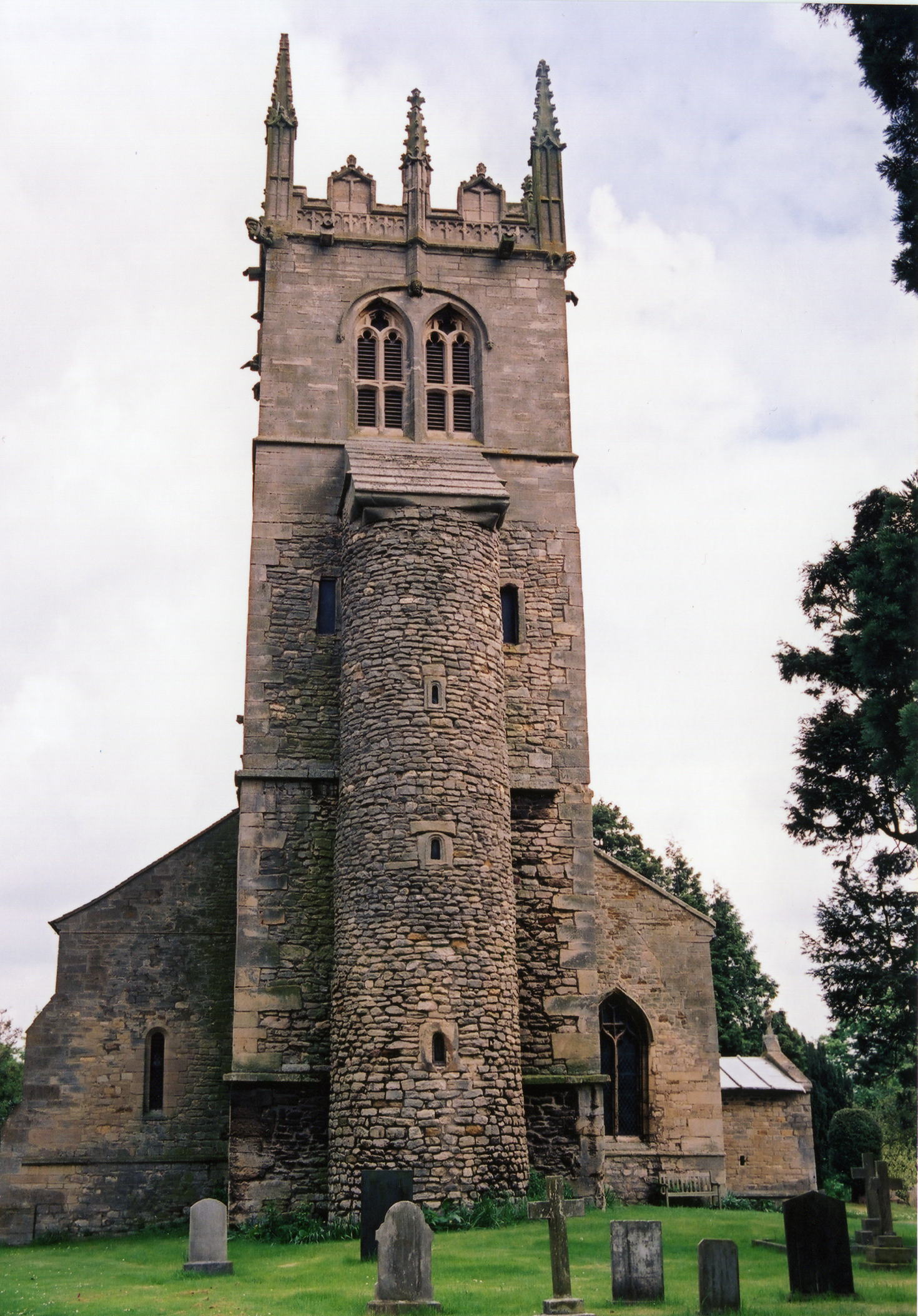
- The church is famous for its Tower with an external stair turret. The church is a Grade I listed structure.
- Richard CROFT has a photograph of the Tower and Turret on Geo-graph, taken in April, 2015.
- Lady Godiva (the Saxon third wife of Siward, Earl of Northumbria, not the Norman one of Coventry) gave the church here to St. Peter of Peterborough around 1050.
- A small priory of Augustine canons was founded here in 1164. It was later seized by Richard II.
- The priory was restored to Cherburgh in Normandy in 1399, but after the suppression of the monasteries, it was granted to Lord RUSSELL in 1541.
- The Church of All Saints contains a coffin-shaped slab preserved from the 14th century with a richly carved foliated cross.
- The church was restored in 1845.
- The church contains monuments to the PAYNE family.
- The church seats about 300.
- A photograph of All Saints is at the Wendy Parkinson English Church Photographs site.
- For more on the church history, see the Hough Parish web site.
- Here are two photos of All Saints Church, taken by Ron COLE (who retains the copyright):


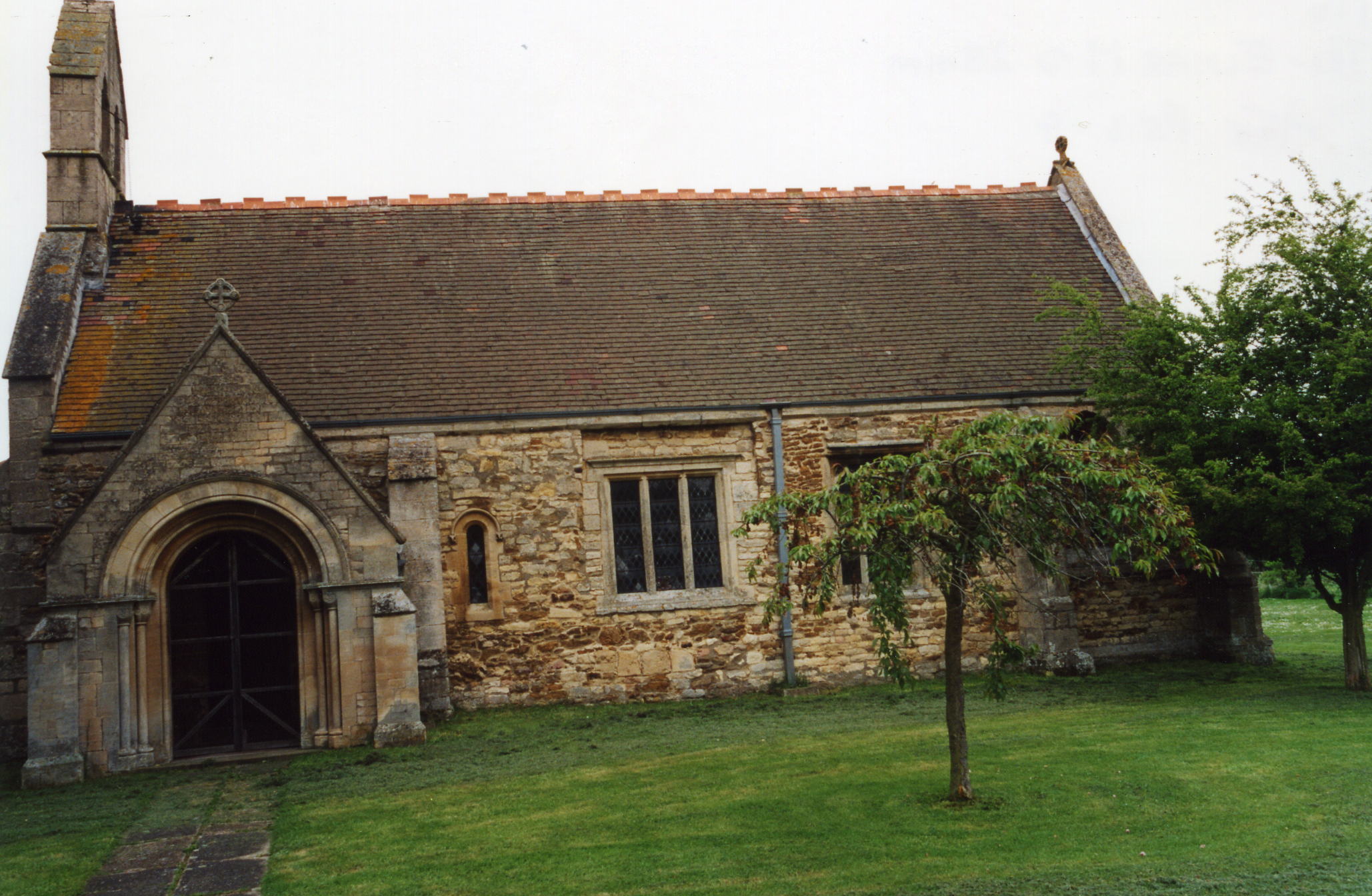
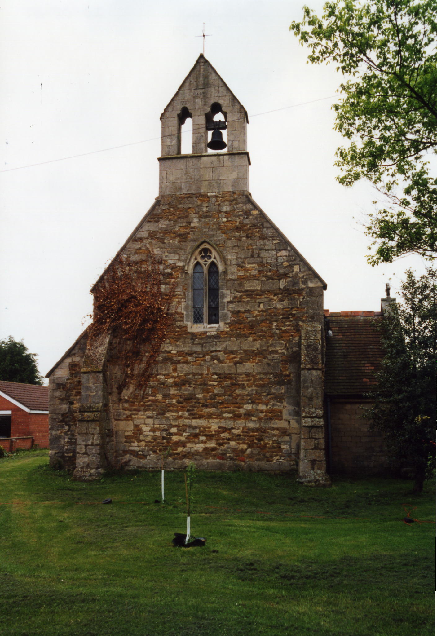
- There was a chapel of ease at Brandon.
- There is a photograph of the church at Brandon on the Wendy PARKINSON Church Photos web site.
- Here are two photos of the chapel at Brandon, taken by Ron COLE (who retains the copyright):


- The Anglican parish register dates from 1562.
- The Lincolnshire FHS has a Loan Library service which has the parish registers on microfiche for Baptisms from 1657 to 1812 and Marriages from 1657 to 1812.
- Boyd's Marriage Index holds parish marriages from 1566 to 1837.
- The Society of Genealogists have the parish registers on file for 1562-1836.
- The hamlet of Brandon had a small chapel of ease, originally built in Norman times, restored in 1872 by the Earl BROWNLOW. Register entries should be found under All Saints.
- The LFHS has published several indexes for the Loveden Deanery to make your search easier.
- The hamlet of Gelston had a Wesleyan Methodist chapel. And Brandon Grange was the site of a meeting house for the Society of Friends. For information and assistance in researching these chapels, see our non-conformist religions page.
- Check our Church Records page for county-wide resources.
- The parish was in the Grantham sub-district of the Grantham Registration District.
- Check our Civil Registration page for sources and background on Civil Registration which began in July, 1837.
This village and parish lies just seven miles due north of Grantham and about nine miles west of Sleaford. Caythorpe parish is just to the northeast, with Normanton parish to the east and Hougham parish to the southwest. The parish covers about 4,000 acres.
The village of Hough on the Hill sits appropriately on a commanding rise. The hamlets of Brandon (two miles north-west of the village) and Gelston (one mile south-west) are part of the parish. Brandon is between two branches of the River Brant (hence its name). On Castle Hill, near the church, are several springs, often cited as the source of the River Brant. If you are planning a visit:
- Hough le Hill is west of the A607 north out of Grantham.
- Visitors may wish to stay at the Brownlow Arms on Frieston Road.
- Martin DAWES has a photograph of the Brownlow Arms on Geo-graph, taken in June, 2013.
- Richard CROFT has a photograph of the Village Sign on Geo-graph, taken in July, 2009.
- Michael GARLICK also has a photograph of the Village Sign on Geo-graph, taken in September, 2016.
- Visit our touring page for more sources.
The National Gazetteer of Great Britain and Ireland - 1868
"BRANDON, a hamlet in the parish of Hough-on-the-Hill, wapentake of Loveden, parts of Kesteven, in the county of Lincoln, 7 miles to the N. of Grantham. It is not far from the Great Northern railway."
"GELSTON, a hamlet in the parish of Hough-on-the-Hill, wapentake of Loveden, parts of Kesteven, county Lincoln, 6 miles N. of Grantham."
- Ask for a calculation of the distance from Hough on the Hill to another place.
- The Domesday Book tells us that Hough was held by Ralf the Staller in 1066.
- Read the 1856 White's Trade Directory entry.
- In 2002, there was an archaeological dig at Hall Close organised by the Grantham Archaeological Group.
- And check the Loveden Org website.
- In 1871, the Earl BROWNLOW was the principal landowner, holding three quarters of the land. Other parcels were owned by the VERE, FELLOWS, MUSSON and GROWN families.
- In 1913, the Earl BROWNLOW was still the principal landowners.
- See our Maps page for additional resources.
You can see maps centred on OS grid reference SK924465 (Lat/Lon: 53.008018, -0.624161), Hough on the Hill which are provided by:
- OpenStreetMap
- Google Maps
- StreetMap (Current Ordnance Survey maps)
- Bing (was Multimap)
- Old Maps Online
- National Library of Scotland (Old Ordnance Survey maps)
- Vision of Britain (Click "Historical units & statistics" for administrative areas.)
- English Jurisdictions in 1851 (Unfortunately the LDS have removed the facility to enable us to specify a starting location, you will need to search yourself on their map.)
- Magic (Geographic information) (Click + on map if it doesn't show)
- GeoHack (Links to on-line maps and location specific services.)
- All places within the same township/parish shown on an Openstreetmap map.
- Nearby townships/parishes shown on an Openstreetmap map.
- Nearby places shown on an Openstreetmap map.
- The War Memorial at Hough on the Hill has been recorded by Mike PECK. The first list is World War One:
| Surname | Given names | Notes |
|---|---|---|
| AYTO | William | |
| ARMSTRONG | Thomas | |
| BAKER | Ernest | |
| DEACON | George | |
| FOX | Herbert | |
| CLEAVER | George | |
| PALMER | William | |
| ANDERSON | Sidney | |
| CARTER | George | |
| HAYWARD | Claude | |
| ADAMSON | Isaac | |
| NORTHOVER | Neville |
- This list is World War Two:
| Surname | Given names | Notes |
|---|---|---|
| McCREARY | A. Wilfrd | Captain, The Loyals |
| BAMFORD | Frank E. | Driver, RHA |
| BAMFORD | J. Archie | L/Cpl |
| LAMB | T. William | Driver, RE |
- The name Hough is Old English haga, or "enclosure". The name has also appeared as Hach. The parish is listed in the 1086 Domesday Book as Hag. It is not clear when the "le Hill" or "on the Hill" suffix was added, but it was apparently done to differentiate the village from similarly named places on railway time tables.
[A. D. MILLS, "A Dictionary of English Place-Names," Oxford University Press, 1991]
- Here's a list of surnames from White's 1871 Directory: ANDREWS, BELL, CHAPMAN, COLLIN, CROW, CUCKSEY, DOLBY, FOOTIT, FREESTON, HARE, KINNY, LILLEY, LORD, MINNITT, MINTA, MITTON, OATES, PRATT, ROBINSON, ROSS, ROWE, SHELBOURN, SIMPSON, SQUIRES, STUFFINGS, SUMMER, TOULSON and WRIGHT.
- Kelley's 1913 Directory lists these surnames: BARNETT, BRATLEY, BURTT, CODD, COLLIN, CRAGG, CROFTS, DOUBLEDAY, FARNSWORTH, GREENSTREET, HARE, HICKSON, HILL, HUNT, LOCK, LORD, PARTRIDGE, PECK, PERKINS, PULLEN, RAWLINSON, SQUIRES, THEAKER, TOULSON, TYLER, WELLS, WHALEY and WHITE.
- The parish was in the ancient Loveden Wapentake in the South Kesteven district in the parts of Kesteven.
- The parish is currently in the Winnibriggs & Threo Wapentake.
- You may contact the local Hough on the Hill Parish Council regarding civic or politcal issues, but they are NOT staffed to help with family history lookups.
- For today's district governance, contact the South Kesteven District Council.
- Bastardy cases would be heard in the Spittlegate (Grantham) petty session hearings.
- After the fields were enclosed here, 17 acres were set aside to produce revenue for the poor, most of which was distributed as coal.
- As a result of the 1834 Poor Law Amendment Act reforms, the parish became part of the Grantham Poor Law Union.
- A school was first built here in 1845 by the then Earl BROWNLOW. A new school was erected in 1867 as the Public Elementary School.
- Richard CROFT has a photograph of the 1867 Schoolhouse at the edge of the churchyard on Geo-graph, taken in July, 2009.
- For more on researching school records, see our Schools Research page.
