Hide
Orby
hide
Hide
hide
Hide
hide
Hide
Hide
hide
Hide
[Transcribed from The National Gazetteer of Great Britain and Ireland 1868]
by Colin Hinson ©2020
Hide
The Community Library at Alford has a local history archive that will prove useful in your research.
Richard CROFT has a photograph of All Saints' churchyard on Geo-graph, taken in April, 2015.
| All Saints, Orby, Church of England |
- The parish was in the Burgh sub-district of the Spilsby Registration District.
- Check our Census Resource page for county-wide resources.
- The table below gives census piece numbers, where known:
Census
YearPiece No. 1841 H.O. 107 / 641 1851 H.O. 107 / 2110 1861 R.G. 9 / 2376 1871 R.G. 10 / 3394 1881 R.G. 11 / 3257 1891 R.G. 12 / 2604
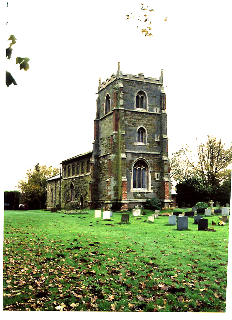
- The Anglican parish church is dedicated to All Saints.
- The church nave was originally built in 1150 and finished around the end of the 13th century.
- The chancel was rebuilt in 1888.
- The west end of the church was damaged by bombing in World War II.
- The church is a Grade II* structure with English Heritage.
- The church seats about 120.
- Check out the church Website for photographs and additional information.
- Here is a photo of All Saints Church taken by Ron COLE (who retains the copyright):

- The Anglican parish register dates from the year 1725.
- We have a small Parish Register Extract text file. Your additions will be welcome.
- The LFHS has published several marriage indexes and a burial index for the Calcewaith and Candleshoe Deanery to make your search easier.
- The Wesleyan Methodists built a chapel here in 1837 to hold about 80 persons.
- J. THOMAS has a photograph of a Converted Chapel on Geo-graph, taken in May, 2020.
- For more on researching these chapel records, see our non-conformist religions page.
- Check our Church Records page for county-wide resources.
- The parish was in the Burgh sub-district of the Spilsby Registration District.
- Check our Civil Registration page for sources and background on Civil Registration which began in July, 1837.
Orby is both a village and a parish that lies west of the Orby Marsh about 9 miles east of Spilsby and 5 miles west of Skegness just north of the A158 trunk road. Burgh le Marsh parish lies to the south, Willoughby parish to the north, and Gunby parish to the west. The parish covers just over 2,000 acres.
The village itself sits on a small rise above the marshland. If you are planning a visit:
- Nearby, Sycamore Lakes offers fishing.
- Visit our touring page for more sources.
The National Gazetteer of Great Britain and Ireland - 1868
- Ask for a calculation of the distance from Orby to another place.
- J. THOMAS has a photograph of the Red Lion Inn on Geo-graph, taken in May, 2020.
- Proprietors of the Red Lion were:
| Year | Person |
|---|---|
| 1919 | Richard D. WILSON |
- See our Maps page for additional resources.
You can see maps centred on OS grid reference TF492673 (Lat/Lon: 53.181883, 0.231233), Orby which are provided by:
- OpenStreetMap
- Google Maps
- StreetMap (Current Ordnance Survey maps)
- Bing (was Multimap)
- Old Maps Online
- National Library of Scotland (Old Ordnance Survey maps)
- Vision of Britain (Click "Historical units & statistics" for administrative areas.)
- English Jurisdictions in 1851 (Unfortunately the LDS have removed the facility to enable us to specify a starting location, you will need to search yourself on their map.)
- Magic (Geographic information) (Click + on map if it doesn't show)
- GeoHack (Links to on-line maps and location specific services.)
- All places within the same township/parish shown on an Openstreetmap map.
- Nearby townships/parishes shown on an Openstreetmap map.
- Nearby places shown on an Openstreetmap map.
- RAF Orby opened in 1941 as a "ground control intercept" (CGI) radar station. It operated as a subsidiary unit of RAF Digby.
- During the war the site operated as a satellite bomb storage dump for RAF Market Stainton.
- RAF Orby closed in August, 1945.
- The site was used for many years as a stock car racetrack.
- This place was an ancient parish in Lincoln county and became a modern Civil Parish when those were established.
- The parish was in the Marsh division of the ancient Candleshoe Wapentake in the East Lindsey district in the parts of Lindsey.
- You can contact the Orby Parish Council regarding civic or political issues, but they are NOT staffed to assist with family history searches.
- Bill HENERSON has a photograph of Orby Village Hall on Geo-graph, taken in April, 2013.
- For today's district governance, see the East Lindsey District Council.
- Bastardy cases would be heard in the Spilsby petty session hearings every other Monday.
- In 1668, an unknown donor left £2, a yearly rent charge, for distribution to the poor. Later donors added to this charity.
- After the 1834 Poor Law Amendment Act reforms, the parish became part of the Spilsby Poor Law Union.
- A Council School was built here in 1836 and rebuilt in 1874 to hold 45 children.
- The Lincolnshire Archives have the Orby School log books from 1875 to 1940 (ORBY CP).
- For more on researching school records, see our Schools Research page.
